| |
Unless indicated otherwise, the maps below are for your personal use only. They may not be used for commercial purposes or reproduced in printed form or on any other web site without the express permission of the copyright owner(s).
To view the larger version of a map, click on its corresponding thumbnail image. (You must have both JavaScript and pop-ups enabled in your browser.) The map will appear in a new browser window, which you can close to return to this document.
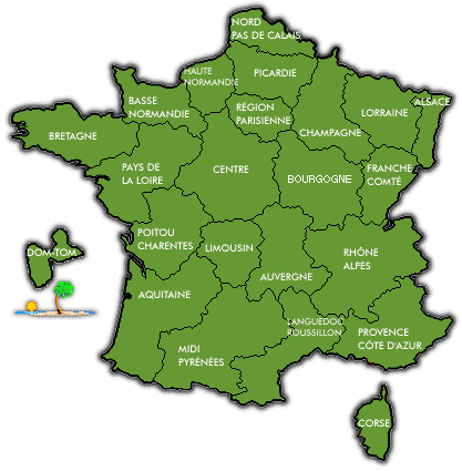
 Maps of France Maps of France |
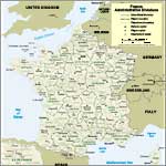
Map of France by Administrative Division (English version)
This map displays the traditional provinces of France by name, the individual departments by name, and the chef lieu (capital) of each department. (File size: 156k.)
Source: U.S. Central Intelligence Agency. Modified by Ian C. Mills at DiscoverFrance.net. Original map is available at the Perry-Castañeda Library Map Collection of the University of Texas at Austin.
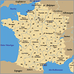
Map of France by Administrative Division (French version)
This map displays both the traditional provinces of France by name, and the individual departments by number. (File size: 100k)
Source: Institut Géographique National (IGN). Low-resolution version is copyright-free, royalty-free.
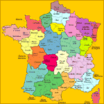
Map of France by Administrative Division
This map displays the individual departments by name, color-coded according to region or historical province. (File size: 59k)
Source: Le SPLAF. Modified by Ian C. Mills at DiscoverFrance.net. Original map is available at Le SPLAF (Site sur la Population et les Limites Administratives de la France).
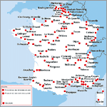
Map of France by Cities
This map displays the major cities of France. (File size: 64k)
Source: Institut Géographique National (IGN). Low-resolution version is copyright-free, royalty-free. Individual city maps are available for sale, starting as low as € 3.33 each plus shipping (shipped from France).
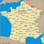
Map of France by Department Capitals
This map displays the chef lieu (capital) for each department of France, along with department numbers and boundaries. (File size: 83k)
Source: Institut Géographique National (IGN). Low-resolution version is copyright-free, royalty-free. Individual city maps are available for sale, starting as low as € 3.33 each plus shipping (shipped from France).
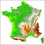
Topographic Map of France
This map offers a view from space, showing the topographic features of France. (File size: 49k)
Source: Institut Géographique National (IGN). Low-resolution version is copyright-free, royalty-free.
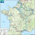
Map of French Waterways
This PDF map displays the rivers, canals, and lakes of France — along with the cities and notable landmarks which line the waterways. A color key identifies which sections are navigable. (File size: 1.3 MB)
Source: Voies Navigables de France (VNF) — 175, rue Ludovic Boutleux, 62408 Béthune.
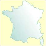
Outline Map of France
This outline map with a white to light-green gradient fill and a transparent background is suitable for customization in your favorite image editing software. (File size: 55k)
Source: Institut Géographique National (IGN). Low-resolution version is copyright-free, royalty-free.
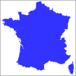
Outline Map of France
This outline map in solid blue with a transparent background offers finer detail of France's borders and shorelines, and is suitable for customization in your favorite image editing software. (File size: 18k)
Source: Institut Géographique National (IGN). Low-resolution version is copyright-free, royalty-free.
|
 Historical Maps of France Historical Maps of France |
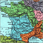
Map of Roman Gaul, ca. 1st century B.C.
This map shows the tribe names and cities as they existed in Roman Gaul (plus portions of Britannia, Germania, the Iberian Peninsula, and Cisalpine Gaul) around or shortly after the Gallic Wars of 58-51 B.C. (File size: 304k)
Source: William R. Shepherd, Historical Atlas (New York: Barnes and Noble, 1929), page 38. Scanned image from Digital Research Library at University of Pittsburgh.
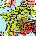
Map of Germanic Kingdoms & East Roman Empire, 526-600 A.D.
This map shows the Kingdom of the Franks during Merovingian rule, plus kingdoms of the Visigoths (Iberian peninsula), Ostrogoths (Italian peninsula), Vandals (Corsica, Sardinia, north Africa), and East Roman Empire. (File size: 204k)
Source: William R. Shepherd, Historical Atlas (New York: Barnes and Noble, 1929), page 52. Scanned image from Digital Research Library at University of Pittsburgh.
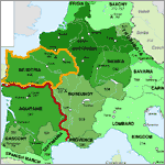
Frankish Empire, 481-814 A.D.
Color coding and a map legend illustrate the rise of the Frankish Empire under Merovingian and Carolingian rule. (File size: 49k)
Source: Wikimedia Commons Graphics Lab adaptation of a map Growth of Frankish Power from William R. Shepherd, Historical Atlas (New York: Henry Holt and Company, 1911), original image courtesy of University of Texas Libraries, The University of Texas at Austin.
|
 Maps of Paris Maps of Paris |
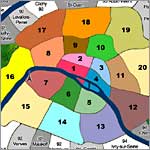
Maps of Paris by Arrondissement (neighborhood)
A map of Paris shows the lay-out of the twenty arrondissements, the forests of Bois de Boulogne and Bois de Vincennes, plus suburbs immediately surrounding the city. Links in the accompanying legend offer individual maps with the streets, landmarks, waterways, and métro stops for each arrondissement.
Source: Discover France. Copyrighted, limited use for non-commercial purposes and school projects (request permission first).
|
 Nominate A Site — Submit An Article! Nominate A Site — Submit An Article! |
|
Maps of France, Provinces, Departments, or Cities
Do you know of a great French map resource we should list here? If so, please submit it!
Are you an author, educator, student or traveler who would like to write an article — or submit your photographs — for the enjoyment of our francophile community? Please download our author's guidelines (48K PDF). Thank you!
|
|
|


