| home | • | bookstore | • | boutique | • | contact us | • | news headlines | • | help! | • | share | • | site map | • | travel center |
 |
 |
 |
| |||||||||||||||||||
| |||||||||||||||||||
|
|
|||
|
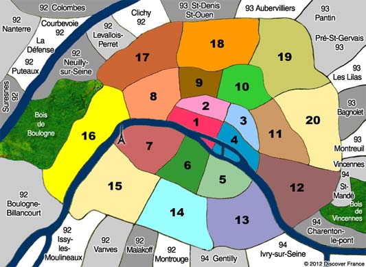
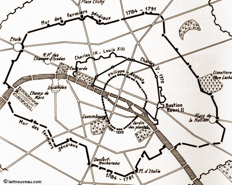
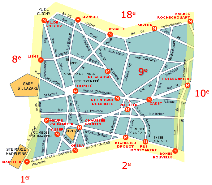
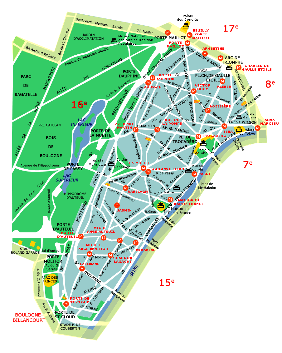
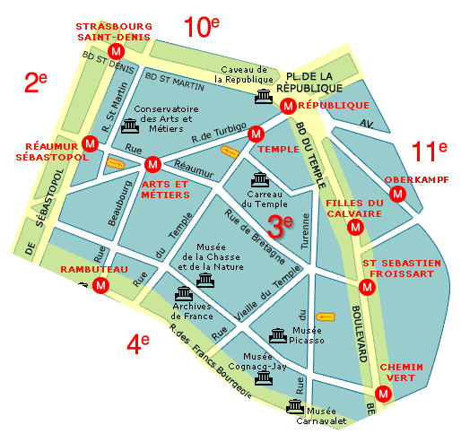
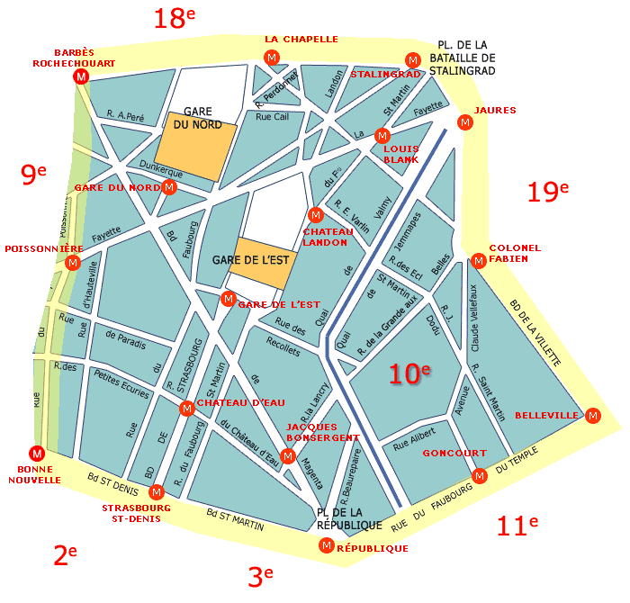
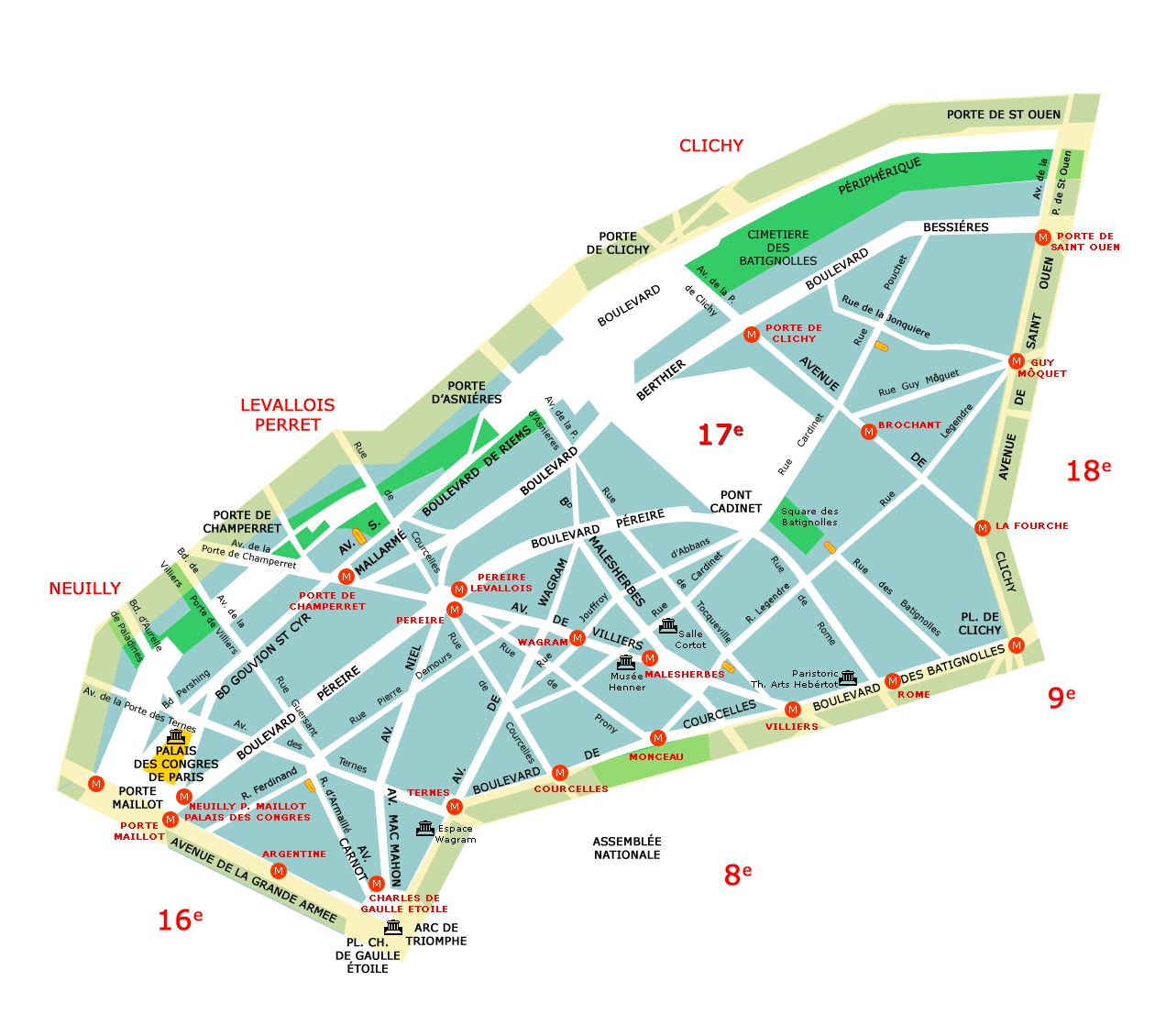
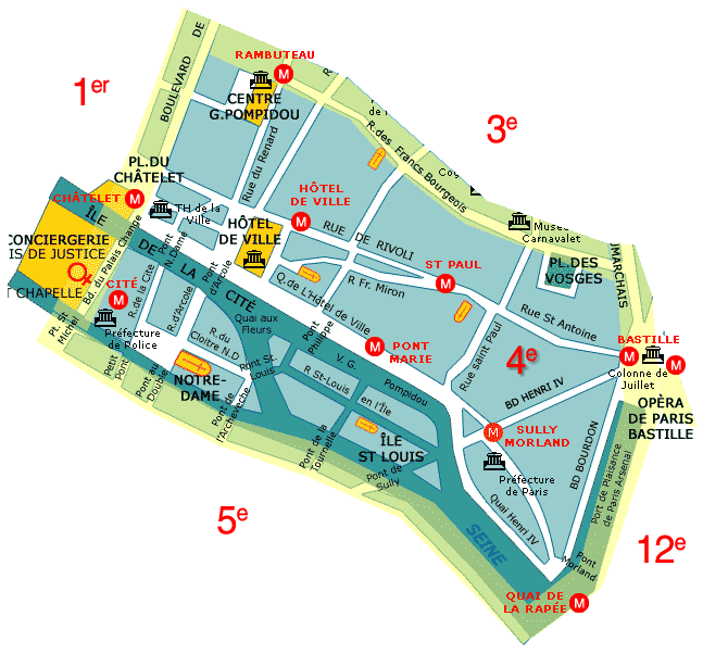
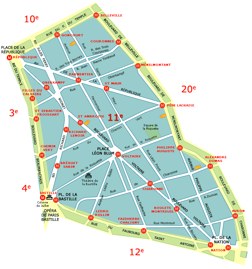
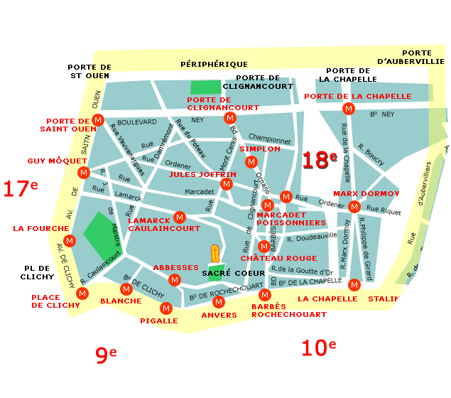
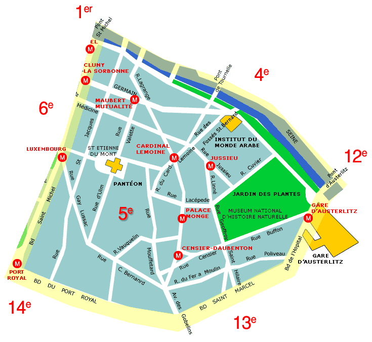
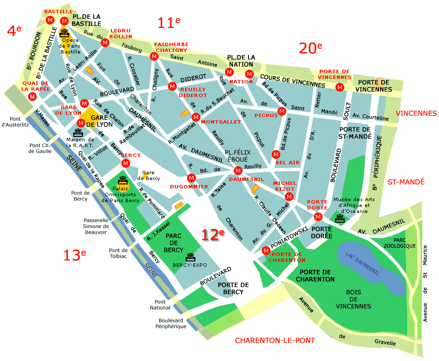
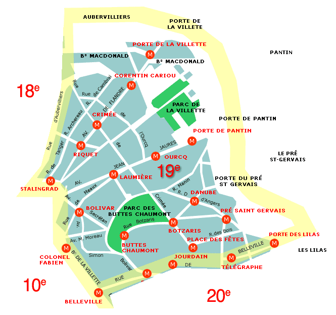
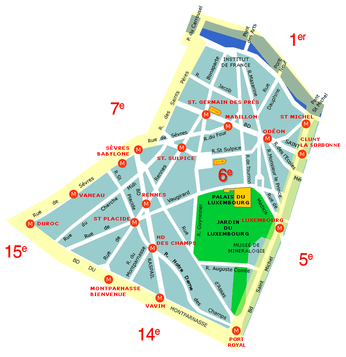
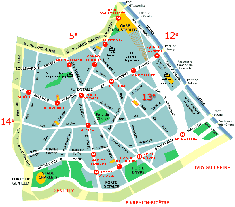
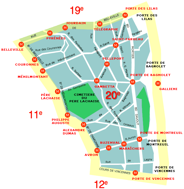
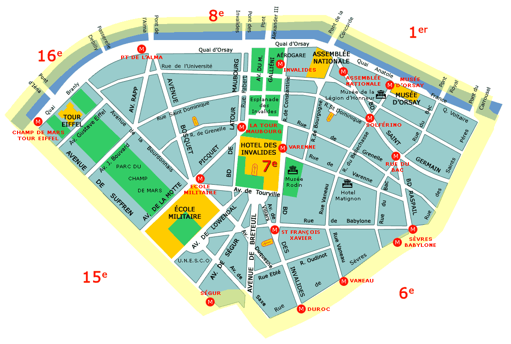
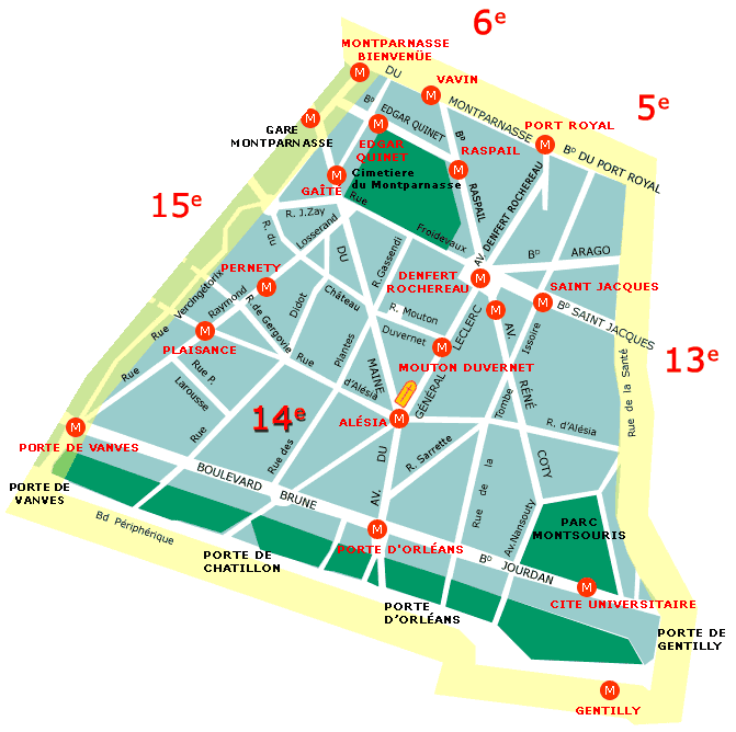
Unless indicated otherwise, the maps provided on this site are for your personal use only. They may not be used for commercial purposes or reproduced in printed form or on any other web site without the express permission of the copyright owner(s). To view a Paris neighborhood map, click on its number in the chart below. (You must have both JavaScript and pop-ups enabled in your browser.) The map will appear in a lightbox over this page; click the 'X' (or anywhere outside the white border) to close the lightbox. A law passed on 16 June 1859 expanded Paris' arrondissements from 12 to the present 20, due to the annexation of neighborhoods which were once situated between the Wall of the Farmers-General (built 1784-1791) and the Thiers Wall (built 1841-1844). See map. By the early 20th century, the Thiers Wall was no longer deemed useful due to advancements in military technology, and it was demolished in stages (1919-1929). Today's Boulevard Périphérique (1958-1973), considered the boundary between Paris and its suburbs, traces the outline of the former wall's outer zone. The circumference of today's arrondissements 1 through 4 traces the medieval Charles V Wall (built 1356-1383) as expanded by Louis XIII (1633-1636). See map. Today's Grand Boulevards (and also the Right Bank portion of Métro line 8) follow the same route as the old walls.
|
|||||||||||||||||||||||||||||||||||||||||||||||||||||||||||||||||||||||||||||||||||||||

|
||||||||||


