| |
One doesn't discover new lands without consenting to lose sight,
for a very long time, of the shore.
Please note: The information presented on this page is presently under research, and is therefore incomplete. Questions and webmaster comments, indicated in bold green type, are directed toward TAAF and IPEV administrations, historians, and any former overwinterers – who are cordially invited to critique and contribute to the content. Thank you for your understanding and/or assistance!
The Art of Living on Kerguelen
A piece of stone at the end of the world
Un bout de caillou au bout du monde (article)
by Virginie Varlet – Le Journal des Flandres, Wed. 11 May 2011
Extract from an interview with Clément Quétel, a 25-year-old from Saint-Paul (Oise, Picardy), who spent 14 months on Kerguelen.
Translated from French and edited by Ian C. Mills.
"At Port-aux-Français, our social spaces include the Bar à Totoche, a post office, the dining room... As far as our meals are concerned, the selection is rather limited because no crops are grown on-site. We eat frozen and canned foods, plus there are sheep raised on the island for our consumption. No money is exchanged – instead, we use tickets for all transactions, and the charges are settled by check at the end of every month."
Thanks to his volunteer status, Clément is fed, housed, and his laundry is taken care of; in addition, he receives a monthly stipend of €900. "Since we don't spend much, it's not too bad after a 14-month stay. It will permit me to complete my studies without worrying about funding."
A physical check-up and a battery of psychological tests are conducted before leaving home: "Even if we're isolated here, we're not alone. Bonds are formed very quickly between those who arrive at the same time. After two days, one has already made friends. And we are stuck in the daily experience here. When you're on the beach in the middle of elephant seals, you can't get tired!"
Time spent on Kerguelen is also an opportunity for volunteers to learn about themselves, for those hardy souls who live in the island's harsh environment – a world away from civilization – will encounter moments of introspection. "If our spirits are low, we simply step outdoors for some fresh air, see penguins all around us, and suddenly everything is good again!"
MidWinter Festival
Overwinterers (fr. les hivernants) at Kerguelen realize they are there for a limited time, and many of them look forward to their departure from this grueling environment. However, the island sojourn is by no means all work and no play.
"On June 21st – the winter solstice in the southern hemisphere, the middle of the rainy season that lasts from April to September – a festival is celebrated throughout the Antarctic and sub-Antarctic islands. Everyone stops working on the international bases to enjoy a well-deserved respite on this social occasion." Once back in France, the former Kergueléniens organize reunions of their repatriated colleagues on the same date.
What did Clément miss the most while living on the island? "Good beers!!!"[1] But he also learned to appreciate a simpler existence: "We quickly realized that there are plenty of things we don't need on a daily basis – such as TV, which offers mostly useless information. I would gladly ignore the fact that Marine Le Pen is doing well. We are so far from everything, but not entirely disconnected either."
Clément Quétel was due to leave for Rennes (capital of Brittany) to transcribe and upload the data he collected at Kerguelen, before finishing his master's thesis the following year. And he says he doesn't plan to leave there anytime soon: "I promised my mother I'd spend Christmas at home."
See Clément's blog about the experience, called "Désolation sous les quarantièmes rugissants" (Desolation in the Roaring Forties).
[1] The most common brand of beer served on Kerguelen is Kronenbourg '1664', a 5.5% abv blonde (lager) dispensed in 330 ml (11.2 fl. oz. US, 11.6 fl. oz. UK) cans. The '1664' name refers to the year when Brasseries Kronenbourg (Strasbourg) was founded.
Gastronomy at Port-aux-Français
This section needs to be expanded to include information about the general nutrition plan implemented on behalf of base personnel by TAAF and the head chef at PAF. Are any sample menus available to illustrate the typical food intake at all three meals? Does TAAF supply wine, hard cider, etc. at certain meals?
TiKer, the Base Refectory
 The renovated TiKer, location of the kitchen,
bakery, dining room, and bar at Port-aux-Français
(click on image to view gallery)
[Description of kitchen facilities, head chef & other dining staff, rotating volunteer staff (fr. Petite Marie); dining room; games room; Totoche bar; etc.]
In the Breton language – whose influence is reflected in many of the names around Kerguelen – "Ty'Ker" means the village house or town hall. At Port-aux-Français, TiKer is the nerve center and social hub of the base: the huge blue and white building houses the kitchens, bakery, dining room, and the popular Totoche bar. One also finds many of the usual diversions here – such as billiards and ping-pong tables, foosball (fr. babyfoot), and dart boards. A music room offers multiple guitars, a drum set, bongos, keyboards, amplifiers, plus a computer with music recording & editing software.
It's at TiKer where a creative culinary team serves up meals morning, noon, and night – no easy task when one considers that fresh fruits and vegetables are generally gone about three weeks after the Marion Dufresne has stopped at the island.
In spite of any supply challenges, one can eat very well at TiKer – perhaps too well, if the assiduous use of exercise machines at the base's gym is any indication. Dining at PAF is about much more than nourishment alone, however: the well-being and morale of an entire base depends to a large degree on the quality of its meals – not to mention the frequency of desserts! It's well-known that the French place great importance on the gastronomical experience, and residents at PAF are no exception; in fact, they can be quite vocal regarding their tastes and expectations.
Christmas Menu 2011
 Christmas dinner menu at
Port-aux-Français, 2011.
(click on image to enlarge)
Assiette de foie gras
et son confit d'oignons
accompagnée d'un pain de mie aux figues
Assiette de Saint Jacques flambées
et son croquant de patates douces
Filet de bœuf champêtre
et son jus aux thym frais
Au palais de la bûche
English translation:
Plate of foie gras and onion confit, accompanied by fig bread;
Plate of flambéed scallops Saint-Jacques and crispy sweet potatoes;
Fillet of country beef in its juice with fresh thyme;
A palatial Yule log.
Sources: Kerguelen - une année sur le seuil du bout du monde, a blog by Véronique Mérour (a.k.a. BibouKer62, the base nurse during mission 62). Le repas en milieu isolé et confiné : entre réconfort et revendication identitaire, by Émilie Giret, from Terrains & travaux 2/2005 (n° 9), p. 12-31; editor: ENS Cachan. Christmas dinner menu at Port-aux-Français, 2011, artist & typesetter unknown, scanned by Mickaël Pacaud, military telecom technician - BCR (mission 62, 2011-12) and published on his blog Mon expérience aux îles Kerguelen.
Facilities and Equipment
Electrical Generation & Heating
Coordinates: 49°20'49.00"S, 70°13'06.19"E or decimal: -49.346944, 70.218386.
 Centrale, the building where electric generators
supply all the power for Port-aux-Français
(click on image to enlarge)
At the northern edge of the Port-aux-Français complex sits a building called Centrale, where most of the electricity for the base is supplied through three 650 kVA diesel generators which operate continuously. The facility also houses two 400 kW electric boilers which supply heat and hot water to the base's buildings.
Consumption of diesel fuel[1] on the base is apportioned as follows:
- 60% for electrical generation;
- 35% for heating requirements; and
- 5% for assorted equipment such as utility vehicles, boats, and independent (free-standing) heaters in annex buildings.
In past years, the two main boilers have supplied heat to both living quarters and technical facilities through traditional hot water circulation methods. However, an extensive renovation project was undertaken during 2011-12 on the L1-L10 living quarters to install new layers of insulation, exterior siding, double-paned thermal windows, and electric heating panels regulated by thermostats.
It is estimated that the base's consumption of diesel fuel could be reduced by as much as 35% through aggressive conservation measures and the use of renewable energy, but the latter solution remains an elusive and vexing target for the district's engineers.
Wind Power: A Practical Solution?
The harnessing of wind power on Kerguelen is not a new subject. With an average annual wind speed of 35 km/h (22 mi./hr.), it would seem that such a generation method is the logical choice. However, gusts on Kerguelen often exceed 150 km/h (93 mi./hr.) and can sometimes reach over 200 km/h (124 mi./hr.), complicating matters due to the extreme stresses placed on turbine design.
In fact, several earlier versions of turbines equipped with wooden rotor blades were installed during the 1990's: one 5 kVA unit situated in an isolated spot at Port Bizet, and two 15 kVA units on the PAF base. All were later removed because they could not handle the extreme wind velocities[2].
Because of the island's remote location (no airport; 6 days by ship from the closest port at La Réunion) and its harsh conditions, the base cannot afford to face a breakdown of its electrical grid. Therefore, the reliability of any new systems – whether powered by wind or water – will face extensive scrutiny and testing before wide deployment can take place.
A new generation of turbines (manufactured by Vergnet SA of Ormes, France) was introduced in recent years, and it was hoped they would endure the physical challenges on the island. Regrettably, their rotors were also smashed by Kerguelen's fierce gales, and the turbines have since been removed.
At this point it seems unlikely that wind power will ever be a viable solution for Port-aux-Français, although the TAAF administration continues to seek innovative ways to reduce consumption of fossil fuels. While geothermal power could be generated by the fumaroles on the island, they are too remote from the base to offer a practical solution. It remains to be seen if water power will be pursued in the future.
[1] The PAF base consumed 1555 m³ (410,790 US gallons) of diesel fuel in 2008 and 1381 m³ (364,820 US gallons) in 2009.
Sources: TAAF report Mise en oeuvre du plan de relance dans les Taaf (PDF). Axel Falguier, Adjunct Director for Conservation of the Nature Reserve, assisted in providing information for this article.
[2] At Amsterdam Island (37°50S, 77°34E, Sub-Antarctic to Oceanic conditions) in December 1986 an experimental vertical axis 10m diameter Darrieus rotor "CEA30-AD10" (3 blades, 67.7 m2 swept area, rated 30 kW at 13.5 m/s) was installed. It showed early promise with daily energy production of 400 kWh recorded for wind speeds ranging from 12 to 25 m/s (Perroud et al., 1991). But serious braking problems threatened on several occasions to destroy the machine. These problems were not solved, partly because of their difficulties and also because the main engineer supporting the project retired. The rotor was locked, then scrapped, the project having lapsed in an atmosphere of general indifference and lack of support.
Potable Water on the Islands
According to Dominique Delarue, a veteran of four separate campaigns[1] to the district, "The Kerguelen Islands possess water of exceptional purity and abundance, a huge advantage in terms of supply for hikers (taafien: les manipeurs). So, when thirsty, one can walk just a few hundred yards to drink from a lake or river – in either case there is no risk. Of course, one should avoid drinking the water around a colony of marine mammals or birds, because in that case it's just awful!"
"In the course of my long trips to the islands, I never bothered to carry a canteen, which is an unnecessary encumbrance. The only exceptions are waters of the eastern Courbet Peninsula which are stagnant and require some research."
[1] 1978-79 (Mission #29) and 1981/1983/1984 (three summer campaigns). See Dominique Delarue's web site, Voyages aux Îles Kerguelen.
Château d'Eau: Water Supply for the Base
Coordinates: 49°20'47.93"S, 70°13'24.79"E or decimal: -49.346647, 70.223553.
Port-aux-Français draws its water supply from an unnamed pond located to the north of the base (behind the Centrale electrical generation building; see photo or satellite view), where personnel are sometimes spotted fishing for trout or salmon. The water is pumped to a purification, storage, and distribution plant known as Château d'Eau, situated northeast of PAF on a rise, at an elevation of roughly 34 m (110 ft.) above sea level.
Average daily water consumption by the base is 20 m³ (5,283 U.S. gallons), peaking at around xx/day during summer months when the population swells to 120 staff. Water is used for food preparation, drinking, showers, washing machines, science labs, fire response, and any other daily living requirements.
While there are three storage tanks with a total capacity of 150 m³ or 39,630 U.S. gallons, only one of them (5 m³ / 1,320 U.S. gallons) is dedicated to holding potable water, i.e. for human consumption. This water is subjected to sand filtration down to 30 microns, then centrifugal filters in three stages – 150, 25, and 10 microns. The next step is UV (ultra-violet) sterilization, and finally a treatment with hydrogen peroxide (in place of chlorine). The treatment facility was last upgraded in 2005.
Distribution to the PAF community is primarily accomplished by gravity-feed, since Château d'Eau is at a higher elevation than the base, but it is supplemented by compressors to achieve suitable water pressure at the faucets. Underground pipes are made of either PVC (polyvinyl chloride) or HDPE (high-density polyethylene).
Due to the network's age, it is not immune to occasional leaks which have exhausted the reserves and interrupted supply in the past – most recently in 2012. Because of its yellowish color (a result of high iron content), the drinking water is affectionately called "Keraline" by base employees.
French Army personnel are recruited in 12-month rotations to handle all infrastructure tasks at PAF; only one person is charged with the water system's daily operation and maintenance.
Note: Water for the remote cabins around Kerguelen is mostly sourced from nearby rivers and streams. When no such source is accessible, large jugs of water are flown to the cabins by the Marion Dufresne's helicopter (if the ship is in port), or driven by tractor from the base.
Sources: Correspondence in November 2013 with Marion François, Director of Technical Services at TAAF headquarters, Saint Pierre, La Réunion. Kerguelen - une année sur le seuil du bout du monde, a blog by Véronique Mérour (a.k.a. BibouKer62, the base nurse during mission 62).
Radar Installations
Former rocket launch site becomes antenna array
Coordinates: 49°21'01.42"S, 70°15'56.67"E or decimal: -49.350394, 70.265742.
Just east of Port-aux-Français was a launching site from 1968 to 1981 for sounding rockets, some for French (Dragon), American (Arcas) or French-Soviet (Eridans) surveys, but at the end mainly for a Soviet program (M-100) called FUSOV – a contraction of Fusées Soviétiques.
Today, this area is the site of a SuperDARN – Super Dual Auroral Radar Network – antenna array, whose purpose is to study the upper atmosphere and ionosphere. One of eleven such sites in the southern hemisphere (there are twenty-one in the north), it was installed during Mission 50 and became operational on 1 January 2000. The network operates in the High Frequency (HF) bands between 8.0 MHz (37m) and 22.0 MHz (14m).
(see a photo or satellite image of the site)
 Starry skies rotate above CNES' radar
dome at the satellite tracking station
(click on image to enlarge)
CNES competes in the space race
Coordinates: 49°21'07.73"S, 70°15'22.96"E or decimal: -49.352147, 70.256378.
The Centre National d'Études Spatiales – CNES (en: National Center for Space Studies) – is the French government space agency established under President Charles de Gaulle in 1961. The organization's headquarters are located in central Paris, and it falls under the supervision of the French Ministries of Defense and Research. CNES operates out of the Toulouse (France) and Guiana Space Centers, but also has payloads launched from space centers operated by other countries. The agency was once responsible for the training of French astronauts, but the last active CNES astronauts transferred to the European Space Agency in 2001.
A CNES rocket and satellite tracking station on Kerguelen was established in 1985. It is situated on a plateau 4 km (2.5 mi.) east of the Port-aux-Français base, accessible via the 'Route 66' road. Part of a worldwide network, its purpose is to track launches of Ariane rockets from French Guiana and to receive telemetry data from 17 satellites, sending trajectory corrections to the spacecraft when necessary to maintain proper orbits.
One of the station's most visible features is its large radar dome, which can be spotted from some distance; the dome serves to protect a large dish against Kerguelen's harsh elements. A geophysical laboratory (fr: Géophy) operated by TAAF/IPEV sits adjacent to the station. In cooperation with agencies such as CNES, CEA (Commissariat à l'Énergie Atomique et aux Énergies Alternatives), CNRS (Centre National de la Recherche Scientifique), and Météo France, fields of study at the labs include earth sciences, seismology, magnetism, ionosphere, atmospheric chemistry, and sea levels.
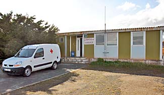
SAMUKER, the Base Hospital
Throughout France, the acronym SAMU stands for Service d'aide médicale urgente (Urgent Medical Aid Service). Thus the name SAMUKER was adopted to mean the urgent medical care provided on Kerguelen, although routine maladies are also covered. In addition to treating island staff, medical personnel are occasionally called on to handle emergency visits by fishermen and sailors from the surrounding territorial waters.
The hospital at Port-aux-Français is equipped with a treatment room, a radiology department, a biological laboratory, a pharmacy, a dentistry department, a sterilization department, an operating room, and two patient rooms.
A pair of medical practitioners — one licensed doctor and one registered nurse — are hired by TAAF for each mission of slightly more than a year's duration. The vetting process is quite rigorous, requiring an interview with TAAF's head doctor in Paris, followed by a series of personality tests, and a one-hour session with a psychologist.
 SAMUKER, the well-equipped hospital
at Port-aux-Français, 2013.
(click on image to view gallery)
Besides the requirement for top-notch professional skills, the idea behind a battery of psychological tests is to screen for any possible mental issues that could arise when spending more than a year in an extremely isolated community, thousands of miles from family and friends, and lacking some of the daily comforts of mainland life (eg. cell phones, broadcast television, high speed Internet, and so on).
Once SAMUKER staff is recruited, there follows a series of medical aptitude examinations, three-month training courses in isolated medicine for the widest possible range of pathologies, and material preparations for departure.
Aurélie Heurtebize, the nurse hired for Mission 58 (Oct. 2007 - Dec. 2008), recounted that “during my over-wintering, there were two major cases of accidental injuries among fishermen, requiring digital amputations on site; but also superinfected abscesses, fractures, and wounds.”
“There is also the ever-present risk of ‘mental wintering syndrome’. During the mission, one wintering employee experienced such difficulties adapting to the isolated environment that his repatriation had to be considered for the next rotation.”
Because patient evacuations can take 10 days or longer due to the island's remote location and access only by sea, preventative medicine and strict safety measures are routine policy in TAAF districts. For example, it is forbidden to leave the base perimeter alone. There must be at least 2 — or even 3 persons — to hike off-base, depending on the area. It is always necessary to carry a first aid kit and a two-way radio, with welfare check-ins made to the base every evening.
Sources: Kerguelen - une année sur le seuil du bout du monde, a blog by Véronique Mérour (a.k.a. BibouKer62, the base nurse during mission 62). A Nurse's Extraordinary Journey to the Kerguelen Islands (English translation) from original interview in French (L'extraordinaire voyage d'une infirmière aux îles Kerguelen) of Aurélie Heurtebize, published 08/17/2015 on Infirmiers.com.
Waste Processing and Recycling
[Description of the former methods to dispose of the base's various waste products – such as dumping garbage and other refuse into the Étang de la Décharge – to the much stricter processing, incineration, and recycling programs being practiced today.]
This section needs input from TAAF representatives and/or past personnel at Kerguelen to provide technical details about the current programs. Images of such new measures are also needed.
Water Craft & Other Transportation
La Curieuse arrived at Kerguelen in 1989, replacing the small fishing boat la Japonaise which had been retrofitted for applications around the island. Chartered by IPEV (French Polar Institute Paul-Émile-Victor), the vessel is used for oceanographic programs and transportation of personnel between the base at Port-aux-Français and destinations outside the Morbihan Gulf via the open seas.
 La Curieuse, a 25m-long ocean research
vessel, moored off the coast of Kerguelen
(click on image to view water craft gallery)
The ship generally moors at a spot near the Île du Cimetière (anchoring at PAF is very poor due to its south-west orientation). Two six-person crews manage the vessel, in rotations lasting about 6 months each. La Curieuse occasionally travels to La Réunion for routine maintenance, and will sometimes carry passengers there as well.
A small barge, L'Aventure II, arrived at Kerguelen during the mid-1980's – replacing its predecessor, L'Oiseau. Chartered by TAAF, it serves to transport passengers (on two or four feet) around the waters of Morbihan Gulf only, since its flat-bottomed design is unsuitable for navigating on open seas. Powered by two 150-hp engines, the 12-ton, 18 m (59 ft.) barge can also transport freight (up to 30 tons) such as food supplies and equipment from the R/V Marion Dufresne II to the base during its four scheduled OP (Opérations Portuaires) visits every year. (see video)
The propellers on the barge are hydraulically adjustable, which makes it a very maneuverable boat, but also quite fragile on impact. Its crew consists of a bosun (taafien: bosco) and a mechanic, both members of the French Navy. For logistical operations, a third crew member may be added. Effective with new rules issued on 5 March 2013, there is a limit of twelve passengers per outing (not including the crew).
The barge le Gros Ventre, which belongs to the Marion Dufresne II and is carried onboard from one island to the next within the TAAF, is an aging utility and cargo vessel dating back to the 1960's. It serves to supplement other means of transporting materials (food supplies, equipment, and refuse destined for La Réunion) between the ship and the various bases. Due to its advanced age, the boat requires extensive rehabilitation between uses.
Sources include:
Les sites annexes de Ker45, a site hosted by Loïc Guérin, VAT (Volontaire à l'Aide Technique) engaged in oceanographic research during mission 45 (Oct. 1994 - Dec. 1995).
Journal Officiel des Terres Australes et Antarctiques Françaises, N° 57 (1er trimestre 2013).
Bienvenue à Port-aux-Frustrés, an article written by Yann Libessart, former district chief (DisKer) 2007-2008, on his blog Les manchots de la République, hosted by Libération.fr.
This section needs to be expanded to include the light trucks and heavy equipment employed at the base. What is the average lifespan of such equipment? What sorts of spare parts are inventoried at the base? Is heavy equipment flown to PAF by helicopter or transferred via barge?
Was there a L'Aventure I after L'Oiseau? If so, what were the years when the various barges were placed into service at PAF?
Off the Beaten Track
Anse du Gros-Ventre
Coordinates: 49°43'02"S, 68°56'04"E or decimal: -49.717222, 68.934444
Gros-Ventre Cove is situated on the southern coast of the Péninsule Rallier-du-Baty. (see map) The cove is named after the ship Le Gros-Ventre commanded by Louis Aleno de Saint-Aloüarn, which sailed from Mauritius on 16 January 1772 alongside La Fortune on the first expedition to find a southern continent, led by Yves-Joseph de Kerguelen-Trémarec.
Although the Gros-Ventre's commander fell ill during the trip, his second-in-command – Charles de Boisguehenneuc – dropped anchor in the cove and embarked with several crew members in the ship's long-boat La Mouche toward shore. Landing at a place now called Plage de la Possession (at the bottom of the long Vallée des Sables), he claimed the island of Kerguelen in the name of King Louis XV while shouting three times, "Vive le Roy!" (Long live the King!) and firing his musket with each cry.
La Base d'ArMor
Coordinates: 49°27'55.79"S, 69°43'41.27"E or decimal: -49.465497, 69.728131.
Lac d'Armor was so named in 1952 by the district chief for Kerguelen, Charles Mouzon, on one of a number of exploratory outings conducted from Port-aux-Français during its second year of operations (Mission #2).
 Base d'ArMor, a fishery established in 1983 on
an isthmus between Lac d'Armor and Baie Hurley
(click on image to enlarge)
On an isthmus separating Lac d'Armor from Baie Hurley (part of the Morbihan Gulf), a fishery was established in 1983 for the introduction of salmon to the Kerguelen islands. Modeled after the sea ranching process (also called aquaculture or mariculture) which had already been proven in New Zealand and Chile[1], the system's goal was to control the maturation of young salmon from incubation of their eggs in a temperature-controlled environment to the smolt stage when they are ready to be released into the sea.
The experiment had actually started much earlier, when 45,000 eggs of Atlantic salmon (Salmo salar) were imported from Denmark in 1975 and incubated at Port-aux-Français, followed by the release of 20,000 surviving fry into the Lac des Korrigans river system to make their way toward the sea. In 1981 the project achieved excellent results with other breeds, such as the Pacific coho salmon (Oncorhynchus kisutch) and its cousin the chinook (Oncorhynchus tshawytscha), which led to the decision to enter into an industrial production phase by building the facility at Base d'ArMor, co-funded by TAAF and SAPMER (Société de Pêche Maritime Et de Ravitaillement, a large sea-fishing enterprise based at La Réunion).
Once they had been at sea for a year, adult fish were expected to return to their birthplace to spawn and then be taken to recover their eggs and repeat the process; however, only a part of the adult population returned. Several other problems arose which managed to eventually cripple the endeavor: the explosion of fish hatcheries in the Nordic countries, and consecutive epidemics of a bacterial kidney disease called Renibacterium salmoninarum. As a result, La Base d'ArMor was abandoned after 1993 and its buildings fell into a state of decay.
Some parts of the base have recently been revitalized for historic purposes and to accommodate hikers – including the rehabilitation of a Fillod cabin[2] with new windows, flooring, door repairs, etc. It is not known whether TAAF will decide to give sea ranching another go in the future.
[1] Today, sea ranching is active in Australia, Chile, China, France, Ireland, Italy, Japan, Mexico, Norway, and the United States. Norway is the leader in salmon aquaculture, contributing 39% of the world's volume; Chile is in second place with 38% (2006 figures).
[2] Véronique Mérour offers an excellent account (in French) and a gallery of photos showing the interior rehabilitation of a Fillod cabin at Base d'ArMor.
Sources: La décote d'Armor, an article written by Yann Libessart, former district chief (DisKer) 2007-2008, on his blog Les manchots de la République, hosted by Libération.fr.
This section needs to be expanded to explain what sorts of activities are being conducted at the fishery now. Is it back in service? What are the protocols for restocking fish in the various waterways on Kerguelen?
Cascades & Waterfalls
- La Grande Cascade de la Rivière du Château - 150 m
- Cascade de la Baie Larose
- Cascade Cachée (Val Studer)
- Cascade Castor et Pollux
- Cascade à Fleur de Roche
- Cascade de Gazelle
- Cascade de L'Isthme du Beau Temps, between the Presqu'île Bouquet de la Grye and Plateau Central.
- Cascade de Port-Couvreux (Rivière de Port-Couvreux )
- Cascade du Ravin du Mica
- Cascade de Studer
- Cascade de La Valdotaine
This section needs to be expanded to include all the catalogued cascades on Kerguelen, along with geographical coordinates and brief descriptions for each.
Cook Ice Cap
The Cook Ice Cap covers an area of approximately 500 km² (190 mi.²) in the western part of Grande Terre, Kerguelen.
xxx
[This section is due to be expanded shortly, following some research.]
Côte des Weasels
 Vestiges of the past: an abandoned
Weasel near Pointe de l'Épave
(click on image to enlarge)
During the first missions to Kerguelen, especially in the 1950s, it was customary to traverse the island on board motorized, tracked vehicles such as the M29 Weasel made by Studebaker, which was designed for operation in snow. This practice was particularly prevalent throughout the Courbet Peninsula. It is the same type of equipment which has served the French Polar Expeditions in Antarctica.
In their writings, geologist Aubert de La Rüe and expedition leader Michel Barré have described their adventures with these contraptions: "At Kerguelen, some of the machines would break down or get mired in the marshy soil, so they were simply abandoned on the spot!"
The Weasel in the left photograph lies on the coast of Baie de l'Aurore Austral (near the mouth of Rivière du Sud at Pointe de l'Épave[1], about midway between PAF and Pointe Molloy). There is also one on the Presqu'île du Prince de Galles.
Some have occasionally been spotted being washed by the tides between Cap Ratmanoff and Pointe Charlotte (on the eastern shores of Courbet Peninsula) – hence the name given to the coast there: Côte des Weasels. (Reference: La Commission de toponymie, 1966-1967; Carte de l'IGN 1967, n° 37)
 An abandoned and decaying Bren Carrier
on Isthme Bas, complete with gun turret
(click on image to enlarge)
Another type of tracked vehicle, the Bren Gun Carrier (built by the British company Vickers-Armstrongs Ltd. between 1934 and 1960), was used by SIDAP during its brief island operations to haul the carcasses of elephant seals back to the factory for processing. SIDAP's founder, Marc Péchenart, had purchased four such vehicles from army surplus stores in Europe. One of these carriers lies abandoned and decaying on the Isthme Bas, sporting what appears to be an original gun turret.
Péchenart was resourceful, having fashioned the trailers from a light stainless steel resistant to Kerguelen's climate, and equipping them with wheels from Lancaster bombers which he had also obtained from army surplus.
While neither the Weasels nor the Bren Carriers are used any longer for transport around the island, one of the latter has been preserved for posterity; it was once on prominent display next to the radio-weather tower (now library) building in the center of campus, but presently resides in the garage while awaiting a place in the future base museum.
[1] Pointe de l'Épave was so named by Raymond Rallier du Baty in 1908-09 upon discovering the remains of a vessel at this location, about which he had remarked, "... a big stream pouring into the sea down a valley in the hills; near here we came across the skeleton of a ship's keel. She had been a sailing boat, a schooner, I should say, of about 150 tons, and now was nothing but a rotten carcass ..." (Reference: Carte de Rallier du Baty, 1922, n° 27)
Sources: Kerguelen - Îles subantarctiques, a blog by Alexandre Knochel, Mission 57. Kerguelen 2011, a blog by Jérôme Perronnet, Mission 61. Pierre Couesnon, Historian for TAAF.
Épave de l'Alberta (Wreck of the Alberta)
 Épave de l'Alberta, wreck of the
Bossière brothers' former sealing ship
(click on image to enlarge)
Coordinates: 49°28'29.75"S, 70°04'26.91"E or decimal: -49.474931, 70.074142
On the western shore of Île du Chat, 7.2 km (4.5 mi.) to the west of Port-Douzième, are the remains of a stranded vessel known as the Épave de l'Alberta. As the story goes, an old seal hunting ship called l'Espérance, which was purchased in June 1928 by the Bossière brothers' company Société des Îles Kerguelen, had anchored and was then abandoned at the Port des Îles (a body of water between Î. aux Cochons, Î. du Chat, and Î. du Cimetière) after its last campaign among the Austral islands concluded in March 1931.
Over time, the ship's rusted state had erased the name Espérance and revealed beneath it the vessel's previous name Alberta, which it had carried when it sailed under the Belgian flag as a coaster (fr. caboteur, a coastal trading ship). It is believed that during World War II, the cruiser Australia scuttled it in shallow water so that the enemy would be unable to use it. At the time, Australia was laying mines in several Kerguelen harbors to prevent German ships from anchoring there. The ship's logs, however, make no mention of the scuttling. (Reference: TAAF, issue #50-51, 1970, pg. 38.)
Sources: Gracie Delépine, Toponymie des Terres Australes (PDF), Documentation Française, Paris, 1973. Pierre Couesnon, Historian for TAAF.
Fumaroles & Hot Springs
Fumaroles are volcanic vents from which steam and volcanic gases issue. The major source of the steam emitted by fumaroles is groundwater heated by bodies of magma lying relatively close to the surface. Carbon dioxide, sulfur dioxide, hydrogen chloride, and hydrogen sulfide are usually emitted directly from the magma. Fumaroles are often present on active volcanoes during periods of relative quiet between eruptions.
 B. Moine and G. Delpech conduct tests of
volcanic gases on a fumarole at Mont des
Fumerolles, Péninsule de Rallier du Baty
(click on image to enlarge)
In areas where the water table rises near the surface, fumaroles can become hot springs. A fumarole rich in sulfur gases is called a solfatara; a fumarole rich in carbon dioxide is called a mofette (French for "noxious fume"), which may also emit methane and other hydrocarbons. Sometimes these noxious gases – which are heavier than air – can settle into depressions in the ground, asphyxiating animal life which wanders into the area. Fumaroles may persist for decades or centuries, if they are above a persistent heat source.
Depending on the mineral content of the different vapors, a mofette (or mofetta) may be used for therapeutic purposes as well. Patients can use it as a dry spa, provided that certain safety protocols are followed. The first known record of mofetta treatment for injuries dates back to the 16th century, as chronicled by the German-Swiss physician Philippus von Hohenheim.
While no volcanic eruptions have been recorded in historic times on Kerguelen, some fumaroles are still active in the southwestern part of Grande Terre – notably at the glaciated Mont des Fumerolles on the west coast of the Péninsule Rallier du Baty (see video); they manifest as somewhat of a haze over the area in a satellite view. Hot springs can be found near the Cabane du Val Travers and in the Vallée de la Grisanche (river) where it flows into Lac Tristan in the Central Plateau. Some of these can attain water temperatures up to 70°C (158°F) and feature colorful growths of algae.
Scientists can measure the relative volume of gas expelled from a fumarole, its temperature, and the level of acidity in the sulfur dioxide, in order to predict whether underlying volcanic activity is increasing or diminishing. Other research on fumaroles involves the study of micro-organisms (hyperthermophiles) which thrive in extreme temperatures, offering clues to the origins of life[1] on earth and possibly on other planets.
[1] For more information, see LUCA (last universal common ancestor) and Archaea.
Sources:
Les Fumerolles des Kerguelen, an article by Francine Buchi on her blog La Petite Chronique de la Terre.
La vie à haute température en Antarctique (PDF), an article by Marc Le Romancer of the Université de Bretagne Occidentale (Brest) in conjunction with IPEV, published by CNRS (Centre National de la Recherche Scientifique).
Diversité géodynamique de l'Outre-mer français (PDF), an article co-written by Pol Guennoc - BRGM, Direction de la Recherche; Pierre Nehlig - BRGM, Service Géologie; and Walter Roest - Institut français de recherche pour l'exploitation de la mer (Ifremer); published by Inria (L'Institut national de recherche en informatique et en automatique).
Wikipedia, the free encyclopedia.
Encyclopædia Britannica.
Finding Shelter on Kerguelen
There are about three dozen cabins or rudimentary shelters strewn throughout the islands – some owned and operated by TAAF, others by IPEV. Many of these outposts are frequented by hikers from Port-aux-Français on a regular basis, whether for work or for pleasure. It is, after all, a scientific community – so research projects in remote locales are commonplace, with some excursions lasting a week or longer.
Accommodations cover the gamut, from comfortable cabins or chalets equipped with running water, heat, full kitchens, indoor toilets and showers – to cramped, spartan affairs which are little more than boxes with doors, offering a camper stove and perhaps an out-house if one is lucky.
The buildings may be constructed of metal (the Fillod[1] style being most common) or wood. Capacities generally range from two to eight campers, although the largest structure can handle up to sixteen; sleeping quarters are usually bunkbeds. With a tinge of humor, veteran overwinterer Dominique Delarue describes the cabin categories as follows:
- With or without rats and mice. The former is evidently the most common, as many hikers have described cleaning up the droppings and disinfecting the cabins before settling in for any stay. The rodents are apparently quite accustomed to these surroundings, and will not hesitate to run across a camper's face while s/he is sleeping.
- With or without heat. The latter category obliges hikers to dry their socks by hanging them over food that is cooking. In heated cabins, one is strongly advised to extinguish the outdated stoves at night, to avoid the possibility of fires or carbon monoxide poisoning.
[1] The characteristic style and shape of these metal buildings, with their sloped roofs and angled walls which resist wind forces very well, identifies them as Les Baraques Fillods, so named after Ferdinand Fillod whose company Constructions métalliques Fillod (CMF, founded 1929) manufactured them. The longer versions, still found at PAF and on other TAAF bases, were once popular choices for French military barracks.
Abri Saint-François
Coordinates: 49°37'10"S, 70°14'35"E or decimal: -49.619444, 70.243056.
Named by the ornithologist Benoît Tollu in 1966, the Abri Saint-François is situated on the Presqu'île Ronarc'h, on the north shore of the Greenland Bay (fr. Baie Greenland), at an elevation of 167 m (548 ft.) above sea level. (see map)
This section needs to be expanded to include information about the shelter (and perhaps a photo), pending inquiries to the DisKer or TAAF headquarters. Who owns and operates it? What scientific missions are usually performed here? Are its geographical coordinates accurate?
Cabane de la Baie Charrier
Coordinates (best estimates, based on available satellite resolution for this region): 49°08'30.91"S, 70°02'08.94"E or decimal: -49.141919, 70.035817.
An inlet from the Golfe des Baleiniers in the northern Courbet Peninsula where anchorage is possible, Baie Charrier was so named in 1932 by geologist Edgar Aubert de La Rüe after Captain Ludovic Charrier, commander of l'Espérance, the seal hunting ship which was abandoned in 1931 when employees of the Société des Îles Kerguelen were summoned to a rescue mission of workers at the Bossière brothers' lobster factory on Saint-Paul Island. (Reference: Carte d'E. Aubert de La Rüe, 1932, n° 29)
Roughly 26.6 km (16.5 mi.) from Port-aux-Français, the tiny weathered cabin faces the bay, opposite the delta of Rivière des Chasseurs which originates from the 733 m (2,405 ft.) Mont Moseley to the south. (see map)
This section needs to be expanded to include information about the cabin, pending inquiries to the DisKer or TAAF headquarters. Who owns and operates this cabin? What scientific missions are usually performed here? What are its geographical coordinates?
Cabane de la Baie Larose
Coordinates: 49°34'17.44"S, 69°20'43.67'E or decimal: -49.571511, 69.345464.
Situated at the Baie Larose on the western shore of the Massif Galliéni, sitting on a grassy strip below Mont Carbenay, the small Fillod-style cabin has a stunning view of the 154 m (505 ft.) volcanic monolith Doigt de Saint-Anne, perched on the water. Beyond it is the strombolian stratovolcano Mont Ross, the highest mountain in the Kerguelen Islands at 1,850 m (6,070 ft.) – rising majestically toward the heavens. The volcano was last active during the late Pleistocene, approximately 200,000 years ago.
Baie Larose was named after Eugène Larose from Normandy, a sailor on the J.B. Charcot during its first expedition by the brothers Henri and Raymond Rallier du Baty at Kerguelen during 1908-09. (Reference: Carte de Rallier du Baty, 1922, n° 27)
The bay, along with part of the south-western slopes of Mont Ross, has been identified as a 20 km² (7.7 mi.²) Important Bird Area (IBA) by BirdLife International, because of its breeding seabirds. Of the penguins, there are some 21,500 pairs of Kings, 500 pairs of Gentoos, 6000 pairs of Macaronis and 4000 pairs of Eastern Rockhoppers. Other birds nesting in the IBA include a few pairs of Wandering Albatrosses, Antarctic and Slender-billed Prions, White-chinned, Northern Giant and Common Diving Petrels, Kerguelen Shags, Kerguelen Terns, Black-faced Sheathbills and Eaton's Pintails. Antarctic Fur Seals and Southern Elephant Seals also breed on the shores of the bay.
Sources: Wikipedia, the free encyclopedia.
This section needs to be expanded to include more information about the cabin, pending inquiries to the DisKer or TAAF headquarters. Who owns and operates this cabin? What scientific missions are usually performed here? Are these geographical coordinates accurate, based on GPS readings taken by hikers?
Cabane Bossière
Coordinates: 49°23'01.88"S, 69°36'26.56E or decimal: -49.383856, 69.607378.
Also called the Cabane du Fjord Henri Bossière, the small metal shack is situated in Kerguelen's Central Plateau, next to a waterfall on the river La Valdotaine which is a spillway for Lac des Deux Îlots. The 33.3 km (20.7 mi.) long fjord culminates at the Golfe du Morbihan. Hikers are generally picked up by the barge L'Aventure II for their return to Port-aux-Français.
The cabin is named after the brothers Henri and René Bossière from Le Havre, who formed La Compagnie des Îles Kerguelen and were granted a 50-year concession on 31 July 1893 by the French government, to develop and exploit the island's resources – activities which were to include coal mining, fishing, whaling, and raising sheep. The brothers subcontracted their whaling activities to a Norwegian company, which established a station at Port Jeanne d'Arc.
Considerable delays in developing the various ventures – due to lack of funds and/or expertise – did not amuse the French Minister of Colonies, who wrote in 1907, "In fact, from 31 July 1893 to January 1907, not one of M. Bossière's business projects has been realised, not a man, not a parcel has been unloaded at Kerguelen, which today is still unexplored and uninhabited."
Nearly twenty years passed before the sheep-raising venture was started, but a flock of 1,000 were finally brought to Kerguelen in 1913. Unfortunately, the location where they were brought was ill-chosen: an arid and inhospitable area on Presqu'île Bouquet de la Grye (see Port-Couvreux), about 12.7 km (7.9 mi.) northeast of the present Cabane Bossière. When World War I broke out a year later, only 200 of the 1,000 had survived, and the venture failed miserably.
Cabane à Cap Cotter
 Installation of a meteorological station
at Cap Cotter, for the glaciology program
(click on image to enlarge)
Coordinates: 49°03'28.24"S, 70°18'17.94"E or decimal: -49.057844, 70.304983.
Situated at the northern-most tip of Courbet Peninsula, Cap Cotter was so named on the Charts of the Admiralty by Captain George Nares of the HMS Challenger in January 1874 after Pownall P. Cotter, "master" of the HMS Terror during the expedition of Sir James Clark Ross in 1840.
The coastline from Cap de Chartres to Cap Cotter is named Côte des Gorfous Dorés (Golden Penguin Coast) after the Macaroni Penguins which are abundant here. While much of the cape's landscape consists of gently rolling hills, the 143 m (469 ft.) Mont Campbell is it's most striking feature.
The dimunitive white pre-fab and red wooden cabins are owned and managed by IPEV. A meteorological station was installed about 50 m (164 ft.) west of the cabin on 15 February 2012 as part of a glaciology program (N° 1048 Glacioclim KESAACO[1]) conducted by the Laboratoire de Glaciologie et Géophysique de l'Environnement, directed by Vincent Favier of the Université Joseph Fourier in Grenoble, France. Materials for the installation were flown in by helicopter from the Marion Dufresne II (OP4-2012), rather than being carried from the base at Port-aux-Français. (read PDF report)
[1] KESAACO = Kerguelen Surface Accumumulation, Ablation and Climate Observatory.
Cabane de Cap Noir
Coordinates (best estimates, based on available satellite resolution for this region): 49°04'39.97"S, 70°27'18.63"E or decimal: -49.077769, 70.455175.
Facing the four winds, Cabane de Cap Noir is owned and operated by IPEV. Consisting of a small wooden Arbec hut next to a pre-fab white research shack, it is situated on the top of a cliff at Anse des Baleines Noires (Black Whale Cove) on the northeastern coast of Courbet Peninsula, between Cap de Rohan and Cap Digby (see map).
The cape was once called Black Fish Bight by Anglo-American hunters (ref. Carte de Nunn, 1850, n°9), and later on Cap Noir by Edgar Aubert de la Rüe in 1952 (ref. Carte de la Péninsule Courbet, 1952, n° 32), before being renamed again to Cap Jeannel by La Commission de Toponymie de l'IGN in 1970 after a professor René Jeannel at the Museum of Natural History in Paris, who was a member of an expedition on the Bougainville[1] in 1939.
[1] The PG-76 Bougainville was a colonial aviso of the French Navy, built at Forges et Chantiers de la Gironde in Bordeaux, launched on 21 April 1931 and placed in active service on 15 February 1933. When rumors circulated that Australia and South Africa were considering the construction of meteorological stations on Kerguelen, the French government felt it needed to reaffirm its sovereignty over the island, and dispatched Bougainville there on a scientific mission in 1939.
This section needs to be expanded to include more information about the cabin, pending inquiries to the DisKer or TAAF headquarters. What scientific missions are usually performed here?
Cabane Le Castel
(see Port-Douzième)
Cabane de Cataractes
Coordinates: 49°9'07.68S, 70°13'53.83E or decimal: -49.152133, 70.231619.
A former geomagnetic station on the north coast of the Courbet Peninsula. At this site an astronomical and geomagnetic observatory was erected on 26 October 1874 by a German research expedition led by Georg Gustav Freiherr von Schleinitz, commander of the imperial corvette Gazelle. The primary goal of this station was the 1874 observation of the transit of Venus[1]. There are still some remains of an old ship's wooden rudder and balustrade on the site, which may have originated from the expedition.
The current twin cabins are situated near the mouth of the Cataractes River, overlooking the Anse Betsy – Betsy Cove, part of the Baie Accessible – Accessible Bay. (see satellite view or IGN map)
[1] Kerguelen was one of the ideal locations from which to observe the Transit of Venus in the southern hemisphere, because the phenomenon was visible during daylight hours there (while it was nighttime in Europe). A British team, led by the Reverend Stephen Joseph Perry, set up several other stations on the island to view this event. The primary one was established on the Presqu'île du Gauss at Observatory Bay (Baie de l'Observatoire, 49°25'11.6"S, 69°53'07.5"E), and two auxiliary stations at Supply Cove and at the base of Thumb Point (Mont Pouce); at the primary site, two white limestone monoliths for mounting the transit telescope, one standing and one lying down (broken into two parts) were removed by archeologists in 2007 and taken to France for restoration. Americans, led by Lieutenant-Commander George P. Ryan, set up another station at Molloy Point on 7 September 1874. Learn more details on the TAAF site; also, see transit times from the years 1639 through 2125.
Cabane de Chez Jacky
Coordinates: 49°19'22.73"'S, 70°7'53.3"E or decimal: -49.322981, 70.131472.
A comfortable chalet located about 1½ hour's walk from Port-aux-Français, along the Rivière du Sud below Val Studer, at an elevation of 49 m (161 ft.) above sea level. Formerly called Cabane du Limnigraphe, it was renovated and expanded almost entirely by Jeannot (the baker/pâtissier at Port-aux-Français) in his spare time, to honor a good friend who was tragically killed in a 2000 hunting accident when the base's doctor slipped on ice and his rifle fired.
The wooden cabin is a favorite refuge for workers at PAF who wish to take a well-deserved break from the stress and boredom of daily existence on the base. Its interior is nicely furnished and includes a well-stocked kitchen complete with a full-sized gas range and oven.
Cabane de Cochons
Coordinates (best estimate, based on available satellite resolution): 49°28'33.43'S, 70°03'16.17"E or decimal: -49.475953, 70.054492.
L'Île aux Cochons is a small island in the Golfe du Morbihan, originally named Hog Island by Anglo-American sealers of the 19th century (Chart of the Admiralty 1874, n° 13). It is one of three islands surrounding that portion of the gulf called Port des Îles (the other two being Î. du Chat and Î. du Cimetière). All pigs have long since been eradicated on this island.
The Arbec-style wooden cabin is situated at the foot of a 120m (394 ft.) peak, on rocky ground with a view of the Épave de l'Alberta (shipwreck) across the water on Île du Chat.
Personnel are brought from the base on board the barge L'Aventure II, which is often accompanied by a number of playful Commerson's dolphins along the way. Once on the island, the scientists' field of study may involve Kerguelen cabbage, or the capture and dissection of mice to determine their genetic differences with other house mice (Mus musculus). Some of the bird species observed at Île aux Cochons include the White-headed Petrel (Pterodroma lessonii), Black Petrel, and the small Common Diving Petrel (Pelecanoides urinatrix).
Who owns and operates this cabin?
Cabane de l'Estacade
Coordinates: 49°16'15.68"S, 70°32'29.83"E or decimal: -49.271022, 70.541619.
Located on the east coast of Courbet Peninsula (Côte des Weasels), half-way between Pointe Charlotte and Cap Ratmanoff, on a rocky slope descending to the sea. L'Estacade was named by H. de Corbiac, geographic engineer, in 1966 (ref. Carte de l'IGN au 1/100 000, 1967, n° 37). (see map)
The cabin xxx.
This section needs to be expanded to include more information about the cabin, pending inquiries to the DisKer or TAAF headquarters. Who owns and operates this cabin? What is its capacity? What scientific missions are usually performed here?
Cabane de la Gazelle
Coordinates (best estimate, based on available satellite resolution): 49°18'15.69"S, 69°41'26.55"E or decimal: -49.304358, 69.690708.
Owned and managed by TAAF, the little red cabin is situated on the south coast of Presqu'île Bouquet de la Grye, facing the Bassin de la Gazelle. While it may not appear so from the outside, it can accommodate up to four hikers at a time in its rather cramped 4m² (43.1 sq. ft.) space.
This section needs to be expanded to include more information about the cabin, pending inquiries to the DisKer or TAAF headquarters. What are its exact geographical coordinates? What scientific missions are usually performed here?
Cabane du Guetteur à Cap Ratmanoff (Watchman's Hut, Cape Ratmanoff)
 A couple of manipeurs observing the Royal Penguins from
Watchman's Hut (La Cabane du Guetteur), Cap Ratmanoff
Coordinates (best estimate, based on available satellite resolution): 49°13'00.27"S, 70°33'16.68"E or decimal: -49.216742, 70.554633.
Situated on the east coast of Courbet Peninsula, Cap Ratmanoff is the site of a geomagnetic station amidst a large colony of Royal Penguins which can number in the hundreds of thousands. The cape was so named in 1932 by geologist Edgar Aubert de la Rüe, after he had met a certain M. de Ratmanoff – a surveyor who was appointed by La Compagnie des Pêches Australes to chart the coastline.
The cabin, consisting of a series of wooden cases assembled to form a kitchen and a bunk block, is quite agreeable after a long hike. There are even toilets – considered the height of luxury in such surroundings! The "watchman" in the cabin's name refers to the scientists' practice of observing the penguin colony from its platform. (see video of penguins surfing the waves, waddling on the beach, and hatching their chicks – plus glimpses inside & outside the cabin)
The skeletal remains of a Soviet-era helicopter wreck can also be found at Cap Ratmanoff. In an old typewritten report, Kerguelen's district chief during Mission 13 relates that a 20,000-ton Russian whaling factory ship, the Yury Dolgoruky, had anchored in Passe Royale (south of Presqu'île du Prince de Galles) along with the supply ship Neva and several smaller whale hunting vessels. On 17 January 1963, during a flight over the Courbet Peninsula, the Dolgoruky's helicopter crashed with no injuries to personnel, and was incinerated under the commander's orders. This occurred during the height of global Cold War tensions (just 3 months after the Cuban Missile Crisis), so there was no question about leaving a piece of Communist technology behind – even in such a remote part of the world.
What are the cabin's exact geographical coordinates?
Sources:
Gracie Delépine, Toponymie des Terres Australes (PDF), Documentation Française, Paris, 1973.
Cold Case sur l'île de la Tentation, an article written by Yann Libessart, former district chief (DisKer) 2007-2008, on his blog Les manchots de la République, hosted by Libération.fr.
Translation, editing, and portions written by Ian C. Mills © 2002-. All Rights Reserved.
 The colorful cabin and out-house on Île Guillou
(click on image for alternate views)
Cabane de Guillou
Coordinates: 49°28'58.82"S, 69°49'08.09"E or decimal: -49.483006, 69.818914.
The Cabane de Gillou and its diminutive but charming out-house are located on Île Guillou, which is just off the southern tip of Presqu'île de l'Amiral Douglas and north of Île Longue across the Passe Colbeck. The island itself is quasi-accessible on foot from the Presqu'île, although one must wait for low tide to do so – otherwise the water's too deep.
A gate was erected across the access point to prevent rabbits and cats from re-populating the island, although that measure has apparently not been fool-proof, as at least one blogger (Clément Quétel, Feb. 2010) reported seeing a feral cat roaming near the cabin. Restoration measures by TAAF eliminated rabbits from Île Guillou in recent years, with an aim toward protecting endemic plant life.
This section needs to be expanded to include more information about the cabin, pending inquiries to the DisKer or TAAF headquarters. Who owns and operates this cabin? What scientific missions are usually performed here?
Cabane de l'Île Australia
Coordinates: xxx or decimal: xxx.
Île Australia (better known as Île aux Rennes or Reindeer Island) is located in the Golfe du Morbihan, between Presqu'île du Gauss and Île Longue. So named by Raymond Rallier du Baty around 1914, and indicated as such on his chart published in 1922 – probably in honor of the Australians who aided the expedition of La Curieuse to return to France in 1914. Previously, the island had been named Elisabeth Island (chart of Émile Werth, 1902) and Carola Insel.
This section needs to be expanded to include information about the cabin, pending inquiries to the DisKer or TAAF headquarters. Who owns and operates this cabin? What scientific missions are usually performed here?
Cabane de l'Île du Château
Coordinates: xxx or decimal: xxx.
xxx
This section needs to be expanded to include information about the cabin, pending inquiries to the DisKer or TAAF headquarters. Who owns and operates this cabin? What scientific missions are usually performed here?
Cabane de l'Île du Cimetière
Coordinates: xxx or decimal: xxx.
xxx
This section needs to be expanded to include information about the cabin, pending inquiries to the DisKer or TAAF headquarters. Who owns and operates this cabin? What scientific missions are usually performed here?
Cabane de l'Île Haute
Coordinates: xxx or decimal: xxx.
xxx
This section needs to be expanded to include information about the cabin, pending inquiries to the DisKer or TAAF headquarters. Who owns and operates this cabin? What scientific missions are usually performed here?
Cabane de l'Île Verte
Coordinates: or decimal: -49.510094, 70.056086.
L'Île Verte is a small, low-lying island (max. altitude 48 m / 157 ft. above sea level) situated in the Golfe du Morbihan 21.44 km (13.3 mi.) from Port-aux-Français, across the Passe de l'Hydrographie from Presqu'île Ronarc'h. It is surrounded by three small islands: Île Inskip, Îlot Greak, and Île du Cimetière. (see satellite view or IGN map)
Once overrun by rabbits which have since been eradicated, the island now sports such an abundance of dandelions in summer, that it might have been more appropriately called L'Île Jaune. Ornithologists come here primarily to study the population of Blue Petrels, or – more precisely – their odors, to better understand how these birds can smell[1] which mate will produce young with the best immune systems.
The Cabane de l'Île Verte and two small storage sheds are perched on a low rocky ledge about 7 m (23 ft.) above water level, facing the Presqu'île Ronarc'h across the pass. There is no electricity, running water, or toilet in the cabin. Rainwater from the roof is diverted into a large yellow storage tank outside, and is suitable for washing; potable water is delivered by the barge L'Aventure II, along with food and other supplies.
[1] Research by the University of Chicago and the Chicago Zoological Society revealed that smells may also help penguins identify their relatives.
Cabane de Korrigan
Coordinates: 49°23'55.71"S, 69°52'45.80"E or decimal: -49.398808, 69.879389.
Owned and operated by IPEV (Institut Polaire Français Paul-Émile Victor), the Cabane de Korrigan is situated on the eastern shore of an inlet from the Baie de l'Observatoire (Observatory Bay) on the Presqu'île du Gauss, facing the Rivière des Korrigans as it empties into the cove. Behind the cabin is a ridge which separates the bay from Lac Eaton. (see map)
Cabane de Laboureur
Coordinates: 49°23'56.72"S, 69°48'22.65"E or decimal: -49.399089, 69.806292.
 The comfortable Cabane de Laboureur
on Presqu'île du Gauss, Kerguelen
(click on image for alternate views)
If there's any place that perfectly represents the potential food resources on Kerguelen, it has to be the Cabane de Laboureur on Presqu'île du Gauss. Located near the top of the Bras Jules Laboureur[1], the cabin site is accessed by barge (l'Aventure II) from the base at Port-aux-Français. (see map)
An early-morning departure treats passengers to a sky dripping with pink and purple hues, while the bay reflects an explosion of pastel colors and fiery bursts from the rising sun. After 2 to 3 hours of navigation, consisting of twists and turns through narrow passages between the islands, then around spits of land in a labyrinthine course, it is possible to confuse the boundaries between the mainland and the Gulf of Morbihan.
The Cabane de Laboureur, owned and managed by TAAF, hosts tourists for a night during the OP (Opérations Portuaires, when the Marion Dufresne II anchors at Kerguelen). It is a small but comfortable cottage on the waterfront, perched beside a waterfall from which running water is pumped – a rare luxury for hikers! A long pontoon dock facilitates disembarking from the barge, just twenty or so meters from the cabin.
Sitting between two fjords – Bras Jules Laboureur to the north and Bras Baudissin to the south – the location is perfectly suited to enjoy marine resources, to hunt reindeer in the central plateau, or to traverse the many rivers and streams leading to the Gulf – where trout and salmon can be found in abundance. When the fish are on a spawning run, it's not unusual for hikers to easily catch them by hand!
[1] Name given by Raymond Rallier du Baty in 1908-09 and 1913-14 (Reference: Carte de Rallier du Baty, 1922, n° 27). Bras Jules Laboureur was formerly called West-Bucht (Carte d'Émile Werth, 1903, n° 21), a name given by the Gauss expedition (1901-1903) which was headed by geology professor Erich von Drygalski. During that mission, five German scientists were dropped off at Kerguelen in 1901 and built a station at Baie de l'Observatoire; they were picked up again in 1903, with the exception of meteorologist Josef Enzensperger, who had died of Beriberi.
Sources: Excerpts translated and edited from a blog by Véronique Mérour (otherwise known as BibouKer62, the nurse during mission 62 at Kerguelen). Visit her site, Kerguelen - une année sur le seuil du bout du monde. Hand-fishing tale from an article Ballades sur la Presqu'île du Gauss et le plateau central by Alexis Chevallier (16 July 2010). Toponomy data from Gracie Delépine, La toponymie de Kerguelen (PDF), Documentation Française, Paris, 1973.
Cabane du Lac des Korrigans
Coordinates: xxx or decimal: xxx.
xxx.
This section needs to be expanded to include information about the cabin, pending inquiries to the DisKer or TAAF headquarters. Who owns and operates this cabin? What scientific missions are usually performed here?
Cabane Manchot
Coordinates: xxx or decimal: xxx.
Situated on the Rivière des Manchots at Cap Ratmanoff, the spacious cabin is owned and managed by TAAF. It is primarily used to house tourists during brief visits from the Marion Dufresne II, but is also occasionally frequented by diehard fishing enthusiasts during leisure outings from the base at Port-aux-Français. (Personnel on scientific excursions tend to prefer staying at the Cabane du Guetteur, because it is closer to the colony of Royal Penguins.)
The cabin is well-equipped, boasting two dorm rooms which can accommodate up to 16 people, a large dining area, kitchen, bathroom, and ample storage space. An electric generator provides lighting and permits running water to be pumped from the adjacent river. Environmental concerns limit visits by tractor from the base, so provisions are generally flown in by helicopter along with the tourists. (PAF personnel stock up on provisions at Kerfour – the food pantry in building B17 – before leaving the base.)
Cabin information kindly provided in consultation with Mickaël Pacaud, military telecom technician (BCR), mission 62 (Mon expérience aux îles Kerguelen).
What are Cabane Manchot's geographical coordinates?
Cabane de Mayès
Coordinates: 49°28'13"S, 69°56'52"E or decimal: -49.470523, 69.947805.
Situated to the east of Île Australia across the Passe de l'Aventure, the island of Mayès is a bird sanctuary teeming with blue petrels, gray petrels, and rockhopper penguins. The TAAF administration maintains a very strict visitation rule here: to minimize any disturbance of the nesting populations, only three scientists are allowed to visit the island at a time. (see map)
It has been said that Mayès is the most beautiful island in the Morbihan Gulf. Visitors there (generally limited to ornithologists) are often struck by the island's abundant vegetation, which consists primarily of Kerguelen cabbage (Pringlea antiscorbutica) and Azorella (a low-growing, mat-forming plant). The absence of any rabbits, rats, or cats on this island (unlike mainland Kerguelen) allows the vegetation to flourish, which creates an excellent habitat for the marine birds.
One of two cabins on the island, the former maroon-colored Auberge du Gros Pétrel Rouge – now known as Cabane des ornithos and colored in two shades of blue – is situated close to the water at the bottom of a steep, thickly vegetated slope crowned by a rocky butte with a sharp cliff face.
Who owns and operates Cabane de Mayès?
Cabane de Molloy
Coordinates: 49°21'36.93"S, 70°03'47.93"E or decimal: -49.360258, 70.063314.
Built in 1955 and renovated in 2003, the large cabin (called le Pavillon) is situated at an elevation of 28 m (91 ft.) above sea level, inland and west from Pointe Molloy, on a rise below the Plateau des Fondrières, overlooking a cove (Anse des Laminaires) of the Morbihan Gulf, with a view of the ridge on Pointe Molloy in the distance. The cabin provides accommodations for eight, with a spacious common area, fully-equipped kitchen, shower and wc. (see satellite view or a detailed IGN map)
There are several outlying structures a short distance from the cabin, which are now abandoned and in ruins; they include a former seismological station (opened ca. 1953, closed 1963) built into a rocky basalt ledge – appropriately nicknamed Maison troglodyte, plus two small utility buildings for electrical generation and batteries.
Pointe Molloy (Molloy Point)
Coordinates: 49°22'1"S, 70°4'48"E or decimal: -49.367069, 70.080276.
Located 10 km (6.2 mi.) west of the present-day Port-aux-Français, along the south coast of the Courbet Peninsula, on the northern shore of the Royal Sound (today's Golfe du Morbihan) – west of the Baie de l'Aurore Australe (see satellite view). Molloy Point was so named on the Charts of the Admiralty by Captain George Nares of the HMS Challenger in January 1874 after William Molloy, a ship's mate on the HMS Terror during the 1840 expedition of Sir James Clark Ross.
On 7 September 1874, an American expedition[1] led by Lieutenant-Commander (USN) George P. Ryan for the U.S. Transit of Venus Commission erected a station at this site to observe the unusual planetary phenomenon[2]. Two iron piers for the heliostat and the photographic plate holder, as well as a brick pier for the transit instrument, are still present today.
 Cabane de Molloy, overlooking the Anse des
Laminaires and a ridge on Pointe Molloy
(click on image to see photo gallery)
[1] See a 29-page report of the transit observations, written by G.P. Ryan, dated February 1875 (printed 1881).
[2] A transit of Venus (seen passing in front of the sun) is among the rarest of predictable astronomical phenomena. Pairs of transits, separated by 8 years, happen every 105.5 or 121.5 years: the last pair occurred in June 2004 and June 2012, the previous pair were in December 1874 and December 1882; the next transits will be in December 2117 and December 2125.
Sources: Wikipedia and Transit of Venus.
Phare de la Pointe Molloy (Molloy Point Lighthouse)
Coordinates: 49°22'7.45"S, 70°4'49.49"E or decimal: -49.368736, 70.080414.
The lighthouse at Pointe Molloy is situated on a promontory 22 m (72 ft.) above sea level on the northwest side of the bay, about 10 km (6.2 mi.) west of Port-aux-Français. Its date of installation is unknown. The fixture is active; it has a quickly flashing white light with a focal plane of 5 m (17 ft.) and a red light that flashes every 2.5 seconds with a focal plane of 15 m (49 ft.).
The lights are mounted on a short post which sits on top of a 4 m high (13 ft.) concrete equipment shelter that is painted white with two black arrows. A distant view is available, and Google has a satellite view. The site is open to all, but the tower itself is closed. (Reference: Admiralty K0820; NGA 33096.)
Sources: Lighthouses of the French Southern and Antarctic Lands and the International Registry of Seismograph Stations.
Cabanes de la Mortadelle
Coordinates: 49°26'39.41"S, 69°12'15.03"E or decimal: -49.444281, 69.204175.
The Cabanes de la Mortadelle are two conventional Fillod-style (steel) buildings sitting on a moraine in the Ampère Plain, not far from the glacier. The cabins are painted bright orange to make them more readily visible to hikers from afar, since fog is commonplace in this area.
On the east side, the ground rises to a 915 m (3,002 ft.) peak that is part of a range called La Grande Barrière. Across the plain on its west side, one can view two smaller mountains from the cabins: the 716 m (2,349 ft.) Les Trois Ménestrels – the Three Minstrels – and the 759 m (2,490 ft.) La Mortadelle – Mortadella, a large Italian sausage.
The Ampère Glacier drains the southeast side of the Cook Ice Cap, which has been steadily shrinking over recent decades – losing 21% of its area between 1963 and 2001. The terminus of the glacier at Ampère Lake has receded by 2800 m (1.74 mi.) from 1963 to 2006; the lake did not exist in 1963. (See satellite view or IGN map; note: the older map does not show the lake, while the newer satellite view does.) At the plain's southern extremity, the glacial water enters the Baie de la Table, west of the Presqu'île du Bougainville.
Cabane Phonolite
Coordinates: 49°37'08.66"S, 70°07'18.22"E or decimal: -49.619072, 70.121728.
Phonolite cabin is situated at the foot of the 400 m (1,310 ft.) massif la Tête d'Homme on Presqu'île Ronarc'h, not far from a narrow strip of land called Halage des Naufragés (literally, "hauling of the shipwrecked") that connects it to Presqu'île Jeanne d'Arc, between Bras Bolinder and the Port Phonolite cove of Baie Greenland. (see map or satellite image)
The term phonolite – after which the cabin, valley, and cove are named – refers to an uncommon green-hued volcanic rock found on the mountain and its surrounding terrain. It is formed from magma with a relatively low silica content, generated by low degrees of partial melting (less than 10%) of highly aluminous rocks from the earth's lower crust.
This section needs to be expanded to include information about the cabin, pending inquiries to the DisKer or TAAF headquarters. Who owns and operates this cabin? What scientific missions are usually performed here?
Cabane de la Pointe du Morne
Coordinates: 49°22'52.27"S, 70°26'41.36"E or decimal: -49.381186, 70.444822.
Originally called Bluff Point (Carte de Nunn n°9, 1850) and subsequently Pointe Escarpée (Carte du Service Hydrographique de la Marine n°4856, 1895), the present-day Pointe du Morne (en. Gloomy Point) was so named by 19th-century seal hunters. It is located on the east coast of Courbet Peninsula, near the north entrance to the Baie Norvégienne (see map).
The cabin is owned and operated by IPEV (Institut Polaire Français Paul-Émile Victor) and contains a common room, a dormitory, and an equipment room; there is also a small green out-house in the garden.
Cabane de Pointe Suzanne
Coordinates: 49°26'20"S, 70°25'60"E or decimal: -49.438889, 70.433333.
The above coordinates need to be verified, as the marker in the satellite view does not appear to be corroborated by photos of the cabin sitting close to the waterline. In addition, information and photos are lacking about a secondary cabin located higher up, where supplies are delivered by tractor from PAF.
Pointe Suzanne is situated on the eastern coast of Presqu'île du Prince de Galles. It was named by Raymond Rallier du Baty in 1908-09 (Carte de Rallier du Baty, 1922, n° 27) after his wife Suzanne[1]. The cabin consists of several brightly colored wooden crates converted into somewhat cramped sleeping quarters and storage, situated near the beach. Because there is no source of fresh water nearby, such as a stream or river, hikers must carefully conserve their limited supplies on hand – conducting any personal hygiene routines at the sea-side.
The atmosphere around the cabin is a little like being in the middle of a zoo: just a few meters away, one is likely to see lounging sea lions, elephant seals, cormorants, Gentoo penguins, giant petrels, wandering albatross and light-mantled sooty albatross.
[1] Pointe Guite on Presqu'&icric;le du Prince de Galles is named after Suzanne's sister, who was the wife of Raymond's brother Henri.
Cabane Port-Bizet
Coordinates: 49°31'01.15"S, 69°54'02.37"E or decimal: -49.516986, 69.900658
A seismographic station overlooking a cove on the northeastern coast of Île Longue in the Golfe du Morbihan, it also served for more than a half-century as the principal farm where the island's resident flock of about 3,500 Bizet sheep were tended. A species endemic to the Massif Central in France, the sheep were first brought to Kerguelen in 1952, and were raised for slaughter to feed the population of scientists and personnel based at Port-aux-Français – until recently. (See video of sheep being herded, sheared, slaughtered, and prepared for a barbecue.)
At the end of 2012, the program was discontinued as part of TAAF's effort to remove introduced species from Kerguelen; since then, the population has been drastically reduced. Despite the fact that Bizet sheep are currently an endangered species on mainland France, there are no plans to repatriate any of the flock from Kerguelen. A TAAF representative[1] explained that such a project would have posed logistical hurdles as well as health and sanitary concerns:
- Because Kerguelen is outside of Europe, transporting the sheep to France would require special authorizations from health officials.
- It was considered that many sheep might not survive the prolonged voyage, and those that did would not have any immunity to viruses in the mainland population.
The Cabane Port-Bizet, situated at an elevation of 28 m (91 ft.) above sea level, is where the island's shepherd – David Grangette – used to live during his annual stays lasting 6-9 months. (During the balance of the year, Grangette maintained the TAAF headquarters' buildings at Saint-Pierre on La Réunion.)
[1] Axel Falguier, Adjunct Director for Conservation of the Nature Reserve, assisted in providing information for this article. Details of recent conservation measures, including various downloadable PDF reports, can be found at La gestion de la Réserve naturelle.
Cabane Port-Christmas
Coordinates: 48°4�1'�S 69°03'E or decimal: xxx.
The wooden cabin is a former geomagnetic station at �Port Christmas on Baie de l'Oiseau[1], in the extreme northwest section of the Loranchet Peninsula. Due to the site's remote location and distance from the base, visitation is somewhat rare; the best access is by sea using the ship La Curieuse.
The port was named Christmas Harbour by Captain James Cook, who first encountered the islands en route to New Zealand in 1776, four years after their discovery by the French. His expedition's two ships, Resolution and Discovery, dropped anchor in the bay on Christmas Day. This is also where Cook coined the name "Desolation Islands" in reference to what he saw as a sterile landscape.
During a shore excursion on 27 December, one of Cook's crew brought back a bottle he had found hanging from a rock, in which a piece of parchment was inscribed with the following:
Ludovico XV galliarum
rege. et d. de Boynes
regi a Secretis ad res
maritimas annis 1772 et
1773
Translation: "In the reign of Louis XV, King of France, the lord de Boynes[2] being secretary of the Marine, in the years 1772 and 1773"
In his Journals[3], Cook wrote that he presumed the bottle had been deposited by Lieutenant Charles Marc du Boisguehenneuc, second-in-command of the ship Le Gros Ventre during Kerguelen-Trémarec's first expedition in 1772. However, this is not accurate; it was actually left on 6 January 1774 by Henri Pascal de Rochegude, one of the officers on L'Oiseau, during Kerguelen-Trémarec's second expedition (which had entered Baie de l'Oiseau in December 1773).
Cook inserted a two-penny coin along with the parchment back into the bottle, then placed it conspicuously atop a pile of rocks on the shore, after having inscribed the back side of the document with the following short declaration:
Naves Resolution
& Discovery
de Rege Magnæ Brittaniæ
Decembris 1776
Translation: "The ships Resolution and Discovery from the King of Great Britain, December 1776"
[1] The bay was named after l'Oiseau, one of Kerguelen-Trémarec's ships on his second voyage to the islands in 1773.
[2] Pierre Étienne Bourgeois de Boynes (1718-1783) was a French magistrate, statesman, and Secretary of the Navy for Louis XV.
[3] The Journals of Captain James Cook on his Voyages of Discovery: Volume III, Part One, The Voyage of the Resolution and Discovery 1776-1780, edited by the historian John Cawte Beaglehole (2 vols., Cambridge, 1967).
This section needs to be expanded to include information about the cabin, pending inquiries to the DisKer or TAAF headquarters. Who owns and operates this cabin? What scientific missions are usually performed here?
Cabane Port-Douzième (literally, Twelfth Port)
Coordinates: 49°30'56.30"S 70°9'07.59"E or decimal: -49.515639, 70.152108
Port-Douzième is a former geomagnetic station situated on the north coast of Presqu'île Ronarc'h, southern shore of the Golfe du Morbihan, about 19 km (11.8 mi.) from the base at Port-aux-Français. It is totally isolated except for its access from the base by boat.
The site was established during the 1950's with the opening of "Le Castel", a cabin 9 m (30 ft.) above sea level on a parcel of coastline with a view dominated by the 744 m (2,441 ft.) mountain le Pouce and facing a number of small islands including Suhm, Malou, Camille, Haynes, Scharbau, Vedette, and Boyle.
 Cabane Port-Raymond, at the
head of Anse de Saint-Malo
(click on image to enlarge)
Cabane Port-Raymond
Coordinates: 49°20'13.42"S, 69°48'44.24"E or decimal: -49.337061, 69.812289.
A scientific camp which has served as a shelter for astronomical observations since 1966. Situated where the Isthme du Lac meets the head of a fjord called Anse de Saint-Malo, which cuts into the Courbet Peninsula from the south. Named after Raymond Guillou, a Petty Officer First Class who died from an illness on 27 September 1966 at Port-aux-Français.
Owned and managed by TAAF, the spacious cabin has a common area which is separate from the sleeping quarters, and the well-equipped kitchen comes complete with porcelain dishware. Thanks to a nearby stream, water is piped into the cabin, and there is even a water heater for much-appreciated showers!
Cabanes du Relais 26 & 27
Coordinates: xxx or decimal: xxx.
(see video)
This section needs to be expanded to include information about the radio relay facility and cabin, pending inquiries to the DisKer or TAAF headquarters. Who owns and operates this unit? What scientific missions are usually performed here?
Cabane Rivière du Nord
Coordinates: 49°10'38.25"S, 70°08'16.80"E or decimal: -49.177292, 70.138.
In the northern part of Courbet Peninsula, old charts drawn by Anglo-American hunters named both the river and the inlet from Baie Accessible into which it flows as the Cascade River (Chart of Captain Robert Rhodes, 1799, n° 7), after the waterfalls which descend from the Monts du Château. Today, the inlet is known as Baie des Cascades; the river was renamed Rivière du Nord by geologist Edgar Aubert de La Rüe in 1952.
The meandering river draws its water from Lac Margot, then heads in a northeasterly direction, fed along the way by the Rivière des Terrasses and numerous tributaries descending from the Plateau Méjean and the Monts du Château.
Owned and managed by TAAF, the twin red wooden cabins are situated toward the east side of the wide river plain, roughly 75 m (246 ft.) from the tip of the bay and 20 km (12.4 mi.) from Port-aux-Français.
This section needs to be researched and completed, pending inquiries to the DisKer or TAAF headquarters. Where are the cascades which feed the Rivière du Nord? What scientific research tasks are performed at this cabin?
Cabane de Sourcils-Noirs
Coordinates: 49°40'52.97"S, 70°14'05.97"E or decimal: -49.681381, 70.234992.
Owned and operated by IPEV, the cabin is situated at the confluence of Rivière Albéric and a seasonal stream, at the bottom of the rocky Cañon des Sourcils-Noirs (Black-Browed Albatross Canyon), on the east coast of Presqu'île Jeanne d'Arc – midway between Cap Donatien Cot and Cap George. (see map or satellite image)
Cabane de la Vallée des Sables
Coordinates: xxx or decimal: xxx.
Located on the southern part of Péninsule Rallier du Baty and culminating at the Plage de la Possession on Anse du Gros-Ventre, the long glacial Vallée des Sables was so named by Raymond Rallier du Baty during his 1908-09 expedition to Kerguelen. (Reference: Carte de Rallier du Baty, 1922, n° 27). It contains numerous streams and rivers fed by the southern glaciers (Arago, Barrabe, Cascade, Cratère, Fallot, La Langue, Plan Praz) of the Cook Ice Cap.
The bright red cabin is a humble affair – little more than a large crate with a door, containing bunkbeds for up to xx hikers.
This section needs to be researched and completed, pending inquiries to the DisKer or TAAF headquarters. Who owns and operates this cabin? What scientific tasks are undertaken here?
Cabane du Val Studer
Coordinates: 49°17'16.42"S, 70°02'53.98"E or decimal: -49.287894, 70.048328.
The cabin is situated in a river plain, just at the foot of Plateau Tussok (elev. 500 m / 1,640 ft.), within a short walk of Lac Supérieur on the Courbet Peninsula. (see satellite view or IGN map)
The installation consists of six non-connected boxes painted in assorted colors, providing sleeping quarters (each box can accommodate two in bunk beds) and storage. Fresh water is supplied through a long white pipe snaking down the embankment, fed by a nearby stream that cascades from the plateau. Due to its remote location and inaccessibility via traditional water routes, non-perishable food supplies and equipment must be flown in from the Marion Dufresne II by helicopter.
While the distance from Port-aux-Français is only 14.13 km (8.78 mi.) as the petrel flies, due to the terrain and unpredictable weather conditions, hikers will sometimes stop to rest or spend a night at Cabane Chez Jacky on the way to Val Studer. Regulations are very strict as to who may take the trip, which requires both advance planning and signed authorizations from various people – including the base physician, director of security, head of services, and finally the district chief. Every hiking group must bring along a VHF radio and check in periodically with the base operator, who is available 24/7. In the event of an emergency communicated by radio, or if the group fails to make contact in a timely manner, a rescue party will be dispatched from the base.
Periods of calm weather are rare and of short duration in Val Studer, which traverses some of the most mountainous parts of Courbet Peninsula. It is perfectly oriented in the windiest direction – west-to-east; frequent gale- or hurricane-force winds blowing across the Baie du Hillsborough are funneled through the valley, multiplying their effect. Even hikers with imposing builds can be blown off their feet, and the cabin walls shudder mightily during storms – in spite of the structures being firmly tethered to the ground at every corner. While fishing for trout in Lac Supérieur is popular among hikers, the winds can make such choppy waves that they resemble those of the ocean at times.
Sources: Geographical coordinates from Wikimedia Labs and Geody. Cartographic maps from Géoportail, le portail des territoires et des citoyens, a service of l'Institut national de l'information géographique et forestière (IGN). Satellite views from Google Earth. Hiking regulations from Séjour aux Kerguelen 2008/2009, a blog hosted by Didier (last name unknown). Weather descriptions from Voyages aux Îles Kerguelen, a site hosted by Dominique Delarue. All Right Reserved.
Cabane du Val Travers
Coordinates: xxx or decimal: xxx.
(see video)
This section needs to be researched and completed, pending inquiries to the DisKer or TAAF headquarters. Who owns and operates this cabin? What are its geographical coordinates?
Assorted notes to be organized and expanded
[This area is for topics which have yet to be researched and developed.]
Guantanamo of the Southern Ocean?
Another solution to becoming a Kerguelenian, admittedly a bit trivial, could have been put in place about thirty years ago. Faced with the imminent abolition of the death penalty, finally voted in October 1981, a few politicians (Michel Aurillac, Alain Peyrefitte) put forward the hazy idea of creating a detention center in Kerguelen for those sentenced to life imprisonment.
The proposal was fortunately deemed too costly, even if it is regrettable that its unfathomable stupidity was not enough to derail it. What a beautiful and noble humanist project indeed, to exile the worst deranged criminal to one of the most isolated places in society where psychological stability is the essential condition for a peaceful stay.
It was well worth closing the Cayenne penal colony [a.k.a. Devil's Island, French Guiana] in 1953, deemed inhumane after destroying the lives of 70,000 convicts over a century, only to try to reinvent it in a sub-Antarctic version of Guantanamo Bay. This stupidity seems buried today, but with all these potential repeat offenders that the justice system doesn't know what to do with, let's remain vigilant.
Although, going on an experiment with Francis Heaulme, spending a night in a cabin with Émile Louis, playing table football (foosball) with Patrice Alègre, or incinerating waste with Michel Fourniret, that would break the monotony of wintering.
Source: Ça vous dirait, le Sud?, an article written by Yann Libessart, former district chief (DisKer) 2007-2008, on his blog Les manchots de la République, hosted by Libération.fr. English translation provided courtesy of Google Translate. Libessart's 224-page book by the same title was published in 2009, available from your favorite bookseller.
Who brought the rabbits? ... and other environmental disasters
[Description of how and by what manner cats, cows, insects, mice, rabbits, and rats were introduced to Kerguelen, the ecological & environmental impact they have had, efforts made to reduce or eliminate the populations, etc.]
Cats were introduced in 1950 to stop the proliferation of mice – which exist on most of Grande Terre, accidentally imported by fishing or expeditionary ships which visited the islands over centuries. The cat population has become feral, surviving over six decades. The problem is that they also feed on small birds, thereby endangering some endemic species. During each year's scientific missions on Kerguelen, there is at least one person whose task it is to survey and tag the cat population, catching them in special cages; that individual is nicknamed popchat in the PAF community.
SIDAP (Société Industrielle des Abattoirs Parisiens)
Seal skins have been used by aboriginal people for millennia to make waterproof jackets and boots, and seal fur to make fur coats. Pelts account for over half the processed value of a seal, selling at over C$100 each as of 2006. Seal hunting is currently practiced in six countries: Canada (where most of the world's seal hunting takes place), Greenland, Iceland, Namibia, Norway, and Russia.
SIDAP, the last sealing enterprise (fr. usine phoquière) on Kerguelen, opened in 1957 and closed around 1960. All the old processing equipment from that facility was finally brought to La Réunion for recycling in 2005, and the building has received a facelift in recent years. [Need more details on this topic...]
À lire! – Recommended Reading
- The Abandonment of Personal Hygiene: L'Abandon des soins corporels (Émilie Giret – Communications, Year 2007, Volume 81, Issue n° 1, pp. 237-243).
- A Complete Guide to Antarctic Wildlife (Hadoram Shirihai & Brett Jarrett – Éditions A & C Black Publishers Ltd., December 2007)
- L'Amiral de Kerguelen et les mythes de son temps (Gracie Delépine – Éditions L'Harmattan, June 1998)
- An Officer of the Blue: Marc-Joseph Marion Dufresne, South Sea Explorer, 1724-1772 (Edward Duyker – Melbourne University Press, 30 April 1994)
- A Practical Guide for the Overwinterer in the French Southern and Antarctic Territories: Guide Pratique de l'hivernant dans les Terres australes françaises (TAAF, 43-page PDF, free)
- L'Arche des Kerguelen (Jean-Paul Kauffmann – Table Ronde, 14 February 2002)
- Au bout du monde, des hommes (Raphaël Ortscheidt – Le Quotidien de la Réunion, Sunday 31 May 2009, 3-page PDF, free)
- Au vent des Kerguelen (Christophe Houdaille – Éditions Transboréal, November 2009)
- Aventures aux Kerguelen [original title: 15,000 miles in a ketch] (Raymond Rallier du Baty – Éditions Maritimes et d'Outre-mer, 14 May 1991)
- Les carnets tempête, Voyage aux îles Kerguelen (Gildas Flahault – Éditions Glénat, October 1996)
- Chronological List of Antarctic Expeditions and Related Historical Events (Studies in Polar Research) (Robert K. Headland – Cambridge University Press, 23 February 1990)
- Contes du Studer - Vieilles nouvelles et histoires de Kerguelen (Michel Janssens – Édition Impossible, Paris, 2008)
- Les Corsaires des Terres Australes (Jacques Nougier – Éditions de la Dyle, 1999)
- Desolation Island (L'Île de la Désolation) (Patrick O'Brian – HarperCollins Publishers, 6 May 1997)
- Un détour par les missions polaires : Enjeux, réflexions, et responsabilités (Amaury Solignac – 48-page PDF, free)
- Le dossier Kerguelen [Broché] (Loïc du Rostu – Édition Klincksieck, Collection: Littérature des voyages, 1 October 1991)
- Enjeux psychologiques du retour de missions isolées : Le cas des hivernants polaires français, Doctoral thesis in psychology at L'Université de Reims, Champagne-Ardenne, 2010 (Amaury Solignac – 693-page PDF, free)
- Histoires extraordinaires et inconnues dans les mers australes: Kerguelen, Crozet, Amsterdam et Saint-Paul (Gracie Delépine – Éditions Ouest-France, Rennes, April 2002)
- History of exotic terrestrial mammals in Antarctic regions (Robert K. Headland – Polar Record, Volume 48, Issue 02, April 2012, pp 123-144; © Cambridge University Press 2011)
- Hoosh: Roast Penguin, Scurvy Day, and Other Stories of Antarctic Cuisine (Jason C. Anthony – University of Nebraska Press, November 2012)
- Les Îles australes françaises (Gracie Delépine – Éditions Ouest-France, Rennes, October 1995)
- Jugement du Conseil de Guerre, tenu au port de Brest, le 15 mai 1775 [rendu contre Yves-Joseph de Kerguelen de Trémanec, commandant du vaisseau le Roland, et ses complices] (Imprimerie de R. Malassis, Imprimeur du Roi & de la Marine, 1775; scanned pages made available by the Bibliothèque Nationale de France, free)
- Ker 12: Le syndrome austral [DVD] (Jacques Nougier – Éditions L'Harmattan, November 2006)
- Kerguelen [German language book] (Max Schmid, André Giret – Birkenhalde Verlag Winterthur [CH], 1998)
- Kerguelen : Le voyageur du pays de l'ombre [Broché] (Isabelle Autissier – Éditions Grasset & Fasquelle, April 2006)
- Kerguelen, l'Archipel de l'Albatros (Natacha Hochman – Marines Editions, 14 April 2003)
- Kerguelen, le phénix des mers australes (Alain Boulaire – Éditions France Empire, 15 June 1999)
- Kerguelen: Le voyageur du pays de l'ombre (Isabelle Autissier – Éditions Grasset & Fasquelle, April 2006)
- Kerguelen, recherches au bout du monde (J.C. Duchêne – TAAF mission de recherche, 1989)
- Les manchots de la République : Un an aux Kerguelen [Broché] (Yann Libessart, preface by Isabelle Autissier – Éditions Les Petits Matins, 5 November 2009)
- Marion Dufresne, Ravitailleur du bout du monde (François Lepage, Caroline Britz – Marines Éditions, March 2012)
- Phoquiers de la Désolation: La Chasse aux Éléphants de Mer aux Îles Kerguelen par les Navires–Usines Français (1925-1931) (Patrick Arnaud, Jean Beurois, Pierre Couesnon, Jean-François Le Mouël – Éditions F. Jambois, 2007)
- Le Piège des Cinquantièmes hurlants (Axel Vachon – Éditions Pierre Téqui, 22 October 2003)
- Les Pirates de légines (Océan Indien Austral) (Jacques Nougier – Éditions L'Harmattan, 1 November 2003)
- Portraits de femmes à Kerguelen au siècle dernier (Gracie Delépine – Terres Australes et Antarctiques Françaises, n° 42-43, January - June 1968, pp. 3-11; full text not available)
- Prospective Recherches Polaires - une prospective de l'Institut Écologie et Environnement (CNRS, Éditions Les Cahiers Prospectives – 64-page PDF, free)
- Rencontres australes (Jacques Mouriès, Pierre Gradoz, Greta Du Bois – Éditions JMO, Le Port [Réunion], 2001)
- Rendez-vous avec le vent (Jean-Paul Giorgetti – privately published)
- Le repas en milieu isolé et confiné : entre réconfort et revendication identitaire (Émilie Giret & Terrains & travaux 2/2005, n° 9, pp. 12-31; editor: ENS Cachan).
- La Ridondaine : Avec Kerguelen et la belle Louison [Broché] (Guillemette Marrier; preface by Roger Vercel – Éditions Plon, 1 January 1945)
- Sous les quarantièmes rugissants : Un sanctuaire sauvage (Charles-André Bost and co-authors – Éditions du Gerfaut, October 2003)
- Le Sphinx des glaces (chapitre 1) (Jules Verne – Hetzel, Paris, 1897; Le Livre de Poche, 15 October 2003)
- Trois Naufrages pour Trois Îles. Terres Australes françaises au XIXe siècle (AMAPOF – Éditions de la Dyle, 1998)
- Voiliers des glaces : aux bons soins d'Éole (Christian Nau – Éditions L'Harmattan, 2000)
Other web sites about Kerguelen
- Découverte de l'île en photos (site d'un hivernant de la 53e mission)
- Vie d'un hivernant pendant son hivernage - Visite de l'île par la randonnée, conseils pour les futurs hivernants
- Géologie de l'archipel des Kerguelen
- Kerguelen - photos
- Actualité juridique de l'Antarctique et des îles subantarctiques
- Escapade de Thierry 'Géophy' de la 44e mission en 1994
- Présentation des ouvrages de J. Nougier
- Site de l'Amicale des Missions Australes et Polaires Françaises
- Un hivernage et trois campagnes d'été dans les îles de la Désolation
- Une carte détaillée des Kerguelen sur le Géoportail de l'IGN
 Kerguelen Links Kerguelen Links |
|
18ème Mission aux îles Kerguelen (1967-68)
A site hosted by Amicale des Missions Australes Et Polaires Françaises (AMAEPF).
6 mois au bout du monde
A bi-lingual blog by Élodie Camprasse, VCAT ornithologist and ecobiologist (IPEV Program 394, mission 62, 2011-2012).
Cap sur les terres australes
A blog by Caroline Britz, co-author of Marion Dufresne, Ravitailleur du bout du monde (March 2012), published by Marines Éditions.
CIA World Factbook: French Southern and Antarctic Territories
Helpful statistics on the region's background, geography, people, government, economy, transportation, military, and transnational issues.
Courant d'Air
A blog by Marine Pouvreau, ecobiologist (mission 61, 2010-11).
Institut Polaire Français - Paul Émile Victor (IPEV)
The institution responsible for directing most of the scientific research missions in the TAAF districts.
Kerguelen 2011
A blog by Jérôme Perronnet, electronics engineering & base logistics (mission 61, 2010-11).
Kerguelen 47e mission (1996-97)
A site hosted by Matthieu Castellazzi; includes a discussion forum.
Kerguelen 57e mission (2006-07)
A page of notes and photos created by Virginie Antoine, microbiologist; hosted by IPEV.
Kerguelen 58e mission (2007-08)
A page of notes and photos created by Aurélie Heurtebize, the base nurse (a.k.a. Bibou58); hosted by IPEV. Aurélie also hosts her own site, La Boîte à BizBon, in collaboration with Arnauld Hibon, former EDK (electrician) during mission 58.
Kerguelen - Îles subantarctiques
A blog by Alexandre Knochel, VCAT ornithologist and ecobiologist (CNRS, mission 57, 2006-07).
Kerguelen - Une année sur le seuil du bout du monde (2011-12)
A blog by Véronique Mérour, a.k.a. BibouKer62, the nurse during mission 62 at Kerguelen.
Kerguelen - Une fragile alchimie de groupe
An article by Ronan Larvor - 10 February 2008, Le Télégramme (in French).
Kerguelen Terns
Accomplished flyers and long-distance travelers, terns are a familiar sight in most coastal waters around the globe. Three species of tern may be commonly seen in the Southern Ocean: Arctic terns, Antarctic Terns, and Kerguelen Terns.
Les manchots de la République
A series of articles written by Yann Libessart, former district chief (DisKer, mission 58, 2007-08); hosted by Libération.fr.
Matthew Parris: The Kerguelen Columns
The (London) Times' parliamentary sketch writer and columnist Matthew Parris first confessed his childhood dream of living on the island of Kerguelen six years ago. After a six-month stay there, he wrote this priceless series of columns about or from the island.
Mon expérience aux îles Kerguelen
A blog by Mickaël Pacaud, military telecom technician - BCR (mission 62, 2011-12).
Open Directory Project: French Southern Territories
The non-profit, human-compiled database provides useful links about the French Southern Territories, in both English and French.
Station Doris
Doris is an antenna relay system which transmits meteorological measurements (humidity, barometric pressure, temperature) from remote locations around the world. This page shows a picture of the installation at Kerguelen, and details the equipment's technical specifications.
Terres australes et antarctiques françaises (TAAF)
The administrative body for the five districts of the French Southern and Antarctic Territories; offices based in Saint Pierre, La Réunion and Paris.
Thomas, ornitho aux Kerguelen
A blog by Thomas Gouello, VCAT ornithologist (mission 61, Nov. 2010 - Mar. 2012).
Un Corbeau aux Kerguelen
A blog by Alexandre Corbeau, VCAT ornithologist and ecobiologist (mission 63, Dec. 2012 - Feb. 2014).
|
| Nominate A Site — Submit An Article! |
|
French Colonies, Overseas Territories
Do you know about a great site we should list here? It can be devoted to any aspect of historical French colonization (people, places, events), or contemporary locations still administered by France – collectively known as DOM-TOM (for départements/territoires d'outre-mer). Please use our convenient Submission Form to send your suggestions!
Are you an author, educator, student or traveler who would like to write an article for the enjoyment of our francophile community? Please download our author's guidelines (48K PDF). Thank you!
|
|
|


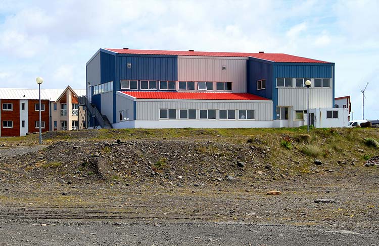


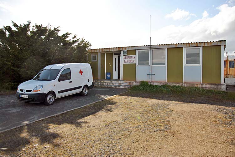
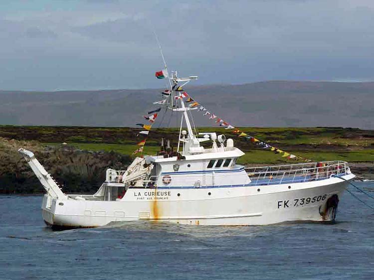


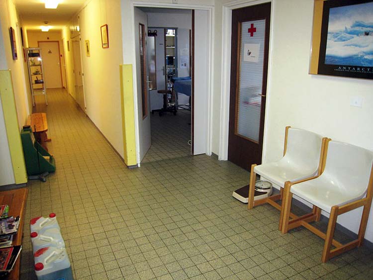
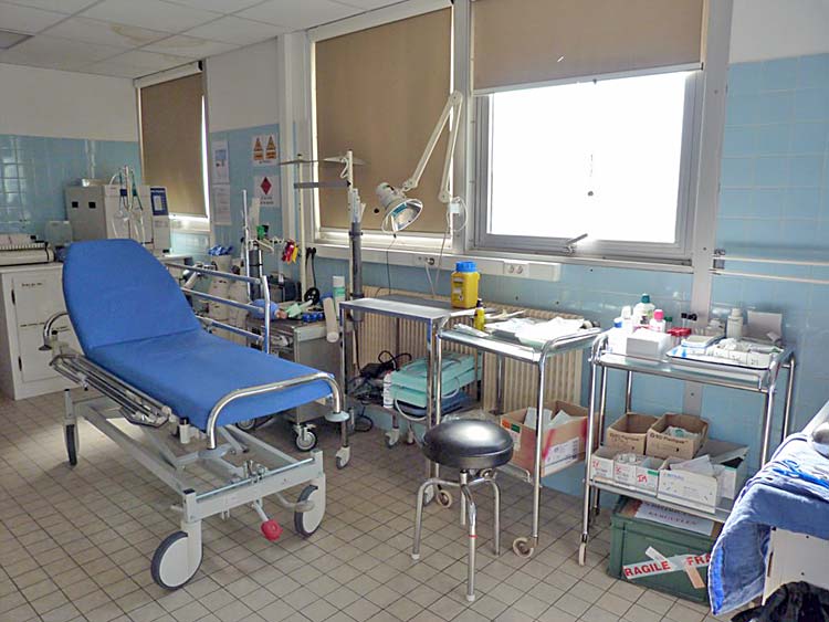
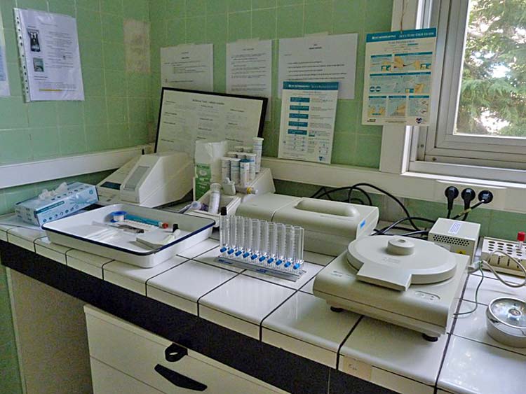
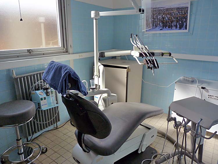
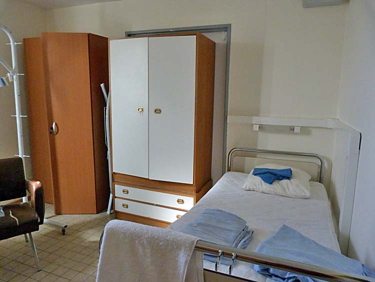
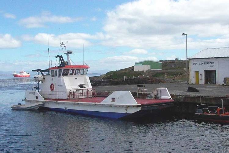
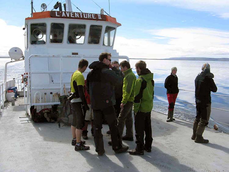
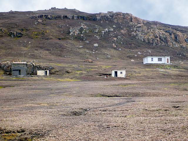
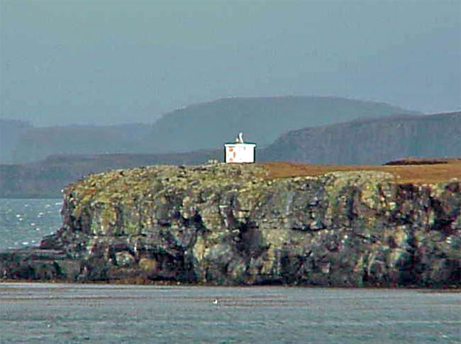