| home | • | bookstore | • | boutique | • | contact us | • | news headlines | • | help! | • | share | • | site map | • | travel center |
 |
 |
 |
| |||||||||||||||||||
| |||||||||||||||||||

|
|
|||
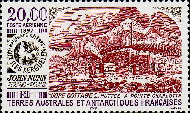
19th to 20th CenturyWhile explorers, whalers and sealers of many nationalities charted and exploited the shores of Kerguelen in the 1700's and early 1800's, nearly a century passed before any French returned. France sent the Commandant Louis Edouard Paul Lieutard aboard the warship L'Eure to reaffirm French sovereignty in 1893, but there were few significant events during the remainder of the 19th Century. The Comte Jean-René-Pierre de Semallé and a M. de Mahy – senator of La Réunion – had proposed that Kerguelen be established as a penal colony, and Vice-Admiral Charles-Jules Layrle had suggested that the island should be used as a coal depot. In 1908, the brothers Henri and René Bossière started a sheep-raising venture (see Port-Couvreux); that miserable failure was followed by a short-lived whaling operation (see Port Jeanne d'Arc), then by a failed colonization attempt. Although scientific expeditions periodically called, the only interest France showed was when the brothers Henri and Raymond Rallier du Baty – aboard the J.-B. Charcot – charted the coast of Kerguelen in 1908-09, returning on La Curieuse in 1913-14. This led to the publication of the first full map of the islands in 1922. Sir Douglas Mawson's British-Australian-New Zealand Antarctic Research Expedition (BANZARE), in the RRS Discovery, visited Kerguelen between 12-24 November 1929 and again between 8-20 February 1930. Edgar Aubert de La Rüe, in the Austral, conducted geological surveys of Kerguelen in 1928, returning in 1930-1931. The following year, he published a definitive study of the island's geology, Étude Géologique et Géographique de l'Archipel des Kerguelen. A French expedition on the Antarès visited Kerguelen in 1931, performing hydrographical, astronomical and magnetic observations. A further French expedition aboard the oceanographic vessel Bougainville visited in 1939 to make a hydrographical survey and to collect biological specimens. 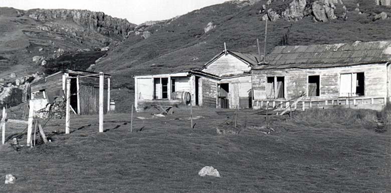
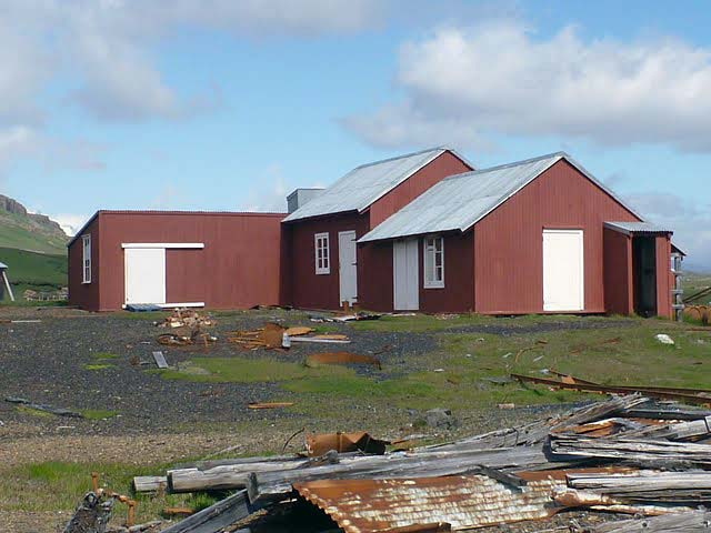
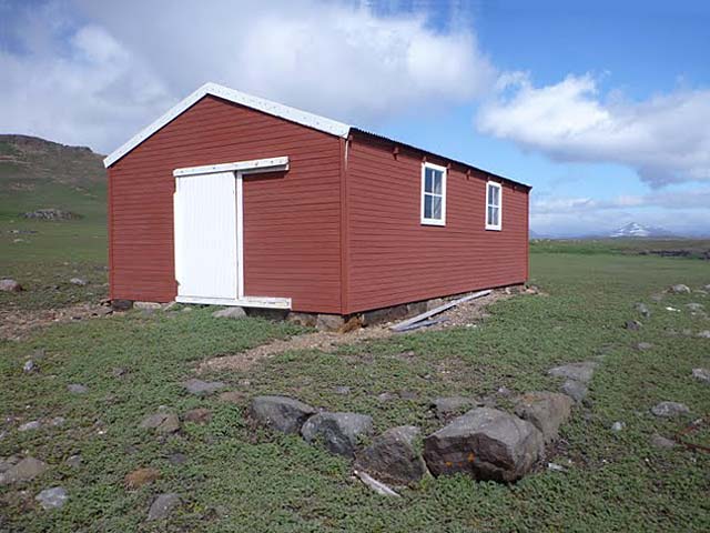
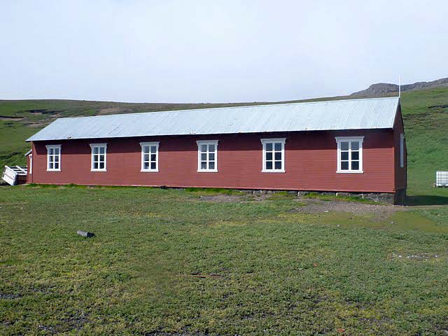
Old cabin at Port-Couvreux (POC) on the east coast of Presqu'île Bouquet de la Grye, Kerguelen (click on image to see photo gallery) Port-CouvreuxCoordinates: 49°17'04.31"S, 69°41'36.35"E or decimal: -49.284531, 69.693431. Port-Couvreux is a former whaling station, experimental sheep farm, and geomagnetic station – situated at a sheltered inlet of the Baie du Hillsborough called Bras de la Fonderie, on the southeast coast of Presqu'île Bouquet de la Grye (see satellite view). The location was first named Port Sulhout by American whalers, then Seelhorst-Hafen after a lieutenant on the German ship Gazelle, who had explored the interior of the Kerguelen Islands on foot in 1889. The brothers Henri and René Bossière built a base here in 1908. Their benefactor, Abel Couvreux, had financed the brothers' expedition that year; he later became president of La Compagnie Générale des Îles Kerguelen in 1914. The Service Hydrographique de la Marine chose the name Port-Couvreux in 1915 to designate both the port and the Bossière base. Starting in 1912, sheep were raised here to create an economic climate for future settlement. However, the attempt failed miserably and the last inhabitants had to be evacuated; the station was abandoned in 1931. Parts of the old huts which still remain today have been renovated as part of an historical conservancy program. Efforts are also made to maintain a nearby cemetery containing five anonymous graves belonging to the settlers who were unable to survive in Kerguelen's harsh environment. (see satellite view or IGN map) Sources: French Wikipedia, the free encyclopedia. Toponymie des Terres Australes, by Gracie Delepine – Documentation Française, Paris, 1973 (922k PDF). Voyages aux Îles Kerguelen, a site by Dominique Delarue. Port Jeanne d'ArcCoordinates: 49°17'04.31"S, 69°41'36.35"E or decimal: -49.552211, 69.820069. PJDA (called Péjida in Ker-speak) is the site of an abandoned whaling station founded in 1908 by the Norwegian company Aktieselskabet Kerguelen (a subsidiary of Storm, Bull & Cie) at the western end of the Presqu'île Jeanne d'Arc's north coast, facing Île Longue across the Passe de Buenos-Aires. (see map or satellite view) A/S Kerguelen had been subcontracted by the Bossière brothers in exchange for production royalties. 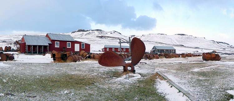
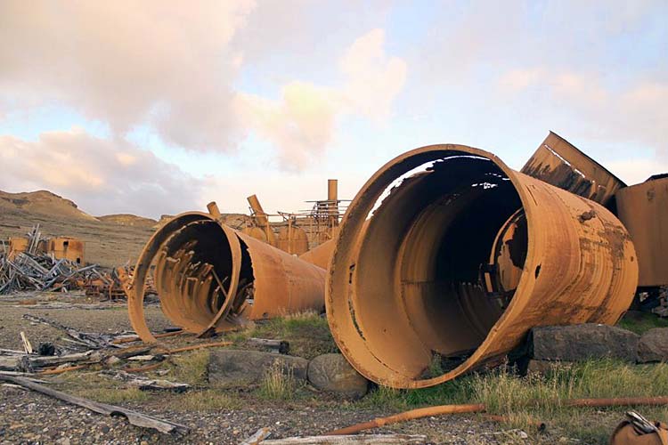
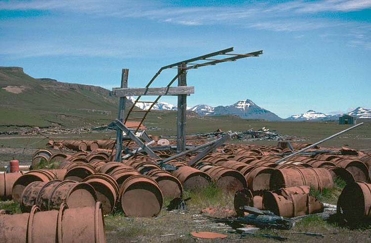
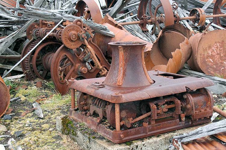
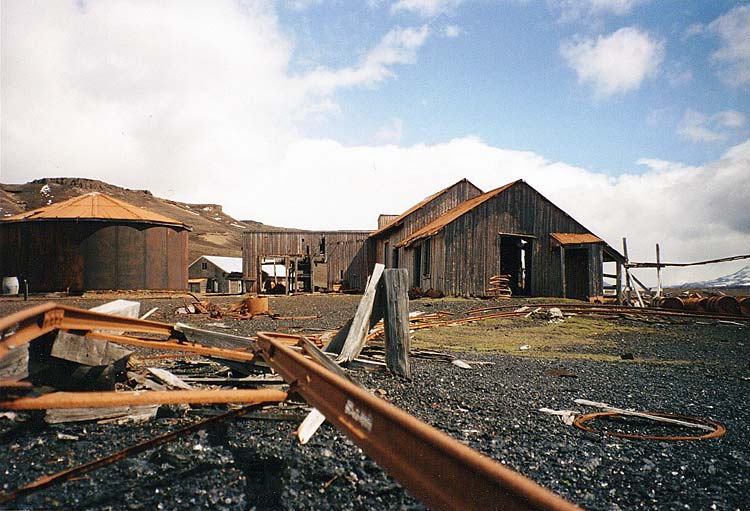
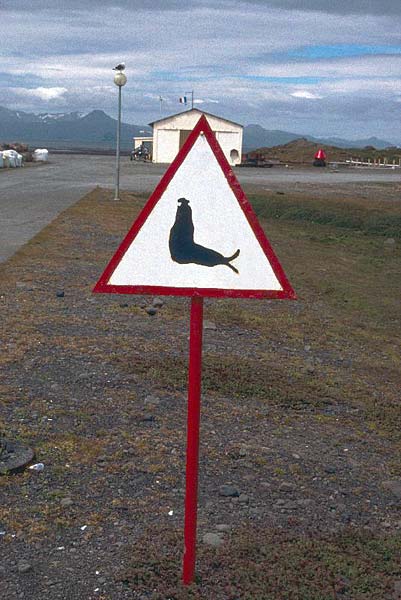
A view of the buildings and a half-buried ship's propellor at Port Jeanne d'Arc on Kerguelen. Photographer: Clément Quétel, mission 60 (click on image to see photo gallery) While the initial whaling campaigns were relatively successful (232 whales were killed during three seasons), the enterprise was gradually replaced by hunting for elephant seals, until operations were interrupted by the outbreak of World War I. Carl Ossian Johnson, a Brit of Swedish descent, purchased A/S Kerguelen from its Norwegian owners in 1919, and formed a new company in 1920, Kerguelen Sealing & Whaling Co. Ltd. Even though the first season was profitable, yielding 17,000 barrels of oil, no expedition was sent for the 1921-22 season – probably due to legalities. Operations resumed thereafter until 1929, when the French authorities failed to renew the agreements. By that time, however, the population of elephant seals had already been decimated on Kerguelen. In the meantime, photographs taken by the scientist Étienne Peau had made their way back to Paris, where a growing outrage at the slaughter instigated the International Congress for the Protection of Wildlife to draw up a proposal in December 1924, calling for the formation of a National Park on Kerguelen. "2,000 tons of oil corresponded to the loss of 30,000 - 40,000 elephant seals." A French newspaper La Revue Scientifique de France said, "Numerous skeletons of seals heap up on the beaches and give our island the disastrous aspect of devastation." In January 1929, the Kerguelen Sealing & Whaling Co. Ltd. had already ventured further south to Heard Island, to resume its hunt there. In recent times, PJDA has been the subject of a cultural heritage conservation program. One of its buildings was restored in 1977; between 2000 and 2007, restoration of the workshop, pig-pen, and residence were completed. Under the guidance of archaeologists and conservationists working on-site, 95% of the buildings' wood was re-used; 4% of the lumber was recovered from other fallen structures at PJDA; and 1% was new wood of the same type and quality as the original. The buildings were then painted in a color which most closely resembles their original appearance in 1908. Some of the massive amounts of "non-historic" scrap metal at PJDA have also been cleaned up, hauled away on the Marion Dufresne and taken to La Réunion for reprocessing. Related article: Restoration of the workshop at PJDA (in French only). Also see a short video trailer about PJDA. World War 2The fjord-like inlets of Kerguelen offered ideal hiding places for Axis Commerce Raiders, and the Allies worried that they could also be used as submarine bases. Visits by German ships during the warOn 14 December 1940, the German auxiliary cruiser Atlantis anchored in the Bassin de la Gazelle at Kerguelen Island, where the crewmen performed maintenance and replenished their water supplies. The ship's first fatality occurred on Christmas eve when a sailor (Herrman) fell while painting the funnel. He was buried in what is sometimes referred to as "the southernmost of all German war graves". The Atlantis departed Kerguelen on 10 January 1941. The Pinguin, a German auxiliary cruiser (Hilfskreuzer) which served as a commerce raider in World War II, tied up in the natural harbor at Port-Couvreux on 13 March 1941. The ship's hull was scraped and cleaned of marine growth and barnacles by careening the ship from one side to the other to expose the hull. The Pinguin's appearance was then changed to take on the identity of the Norwegian liner Tamerlane. After replenishing its water supply from the Cascade de Port-Couvreux using a gravity-feed system, Pinguin departed the islands on 25 March. Kerguelen was also visited by the German ships Adjutant, Alstertor, and Komet around the same timeframe. Suspecting the presence of enemy ships at Kerguelen, the Royal Navy vessel Australia inspected the islands between 1 and 4 November 1941. Having found traces of the German ships' passage, it planted mines in four strategic locations: at the Détroit de Tucker, in the Bassin de la Gazelle, at Port des Îles, and in the channel to the east of Île Longue. Post-War YearsFollowing the Second World War, the Australian National Antarctic Research Expeditions (ANARE) regularly visited Kerguelen between 1947 and 1954, and France was obliged to occupy the island to retain sovereignty. In December 1949, a temporary base was established at Port-aux-Français by Pierre Sicaud, with the ships La Pérouse and Commandant Charcot. In January 1951, Sicaud returned on the Italo-Marsano to create a permanent meteorological station; this was the first over-wintering at the Port-aux-Français base. On August 6, 1955, a French law was passed – creating the new autonomous territory of Terres Australes et Antarctiques Françaises (TAAF). During 1956-1957 the TAAF established at Port-aux-Français a geophysical station for observations in meteorology, geomagnetism, aurora and airglow, ionospheric physics, cosmic rays and seismology. This was to become part of the French contribution to the International Geophysical Year (IGY). The station's site was selected because of its sheltered position in the Baie de l'Aurore Australe (a bay of the Morbihan Gulf), which was suitable for an airport runway that was never built. From 1955 to 1957, using Australian equipment, a French slaughterhouse company called Sidap constructed a sealing factory. The factory opened following the first marriage on the islands, that of Marc Péchenart and Martine Raulin on 16 December 1957. The factory closed in 1960, and the equipment was sent to Réunion in 2005. The Present-Day Base StationGeographical distances: According to Google Maps' Distance Calculator, the distance between Point Zero (as indicated by a brass marker embedded in the Parvis de Notre-Dame, Paris) and the center of Port-aux-Français, Kerguelen (as determined by the middle of the current library's roof) is 12,712.138 km or 7,898.956 miles / 6,864.008 nautical miles. Where indicated, distances of Kerguelen landmarks noted on these pages are measured (using the Haversine formula) from the Port-aux-Français library, and may be accurate to within a matter of meters or more, depending upon whether the landmark could be seen and pin-pointed reasonably well in the Landsat images provided by Google Earth. In cases where landmarks could not be detected with reasonable clarity in satellite images, the published coordinates are indicated as best estimates. Please contact Discover France if you wish to offer corrections to this data, or to contribute any additional content about Kerguelen. Thank you. 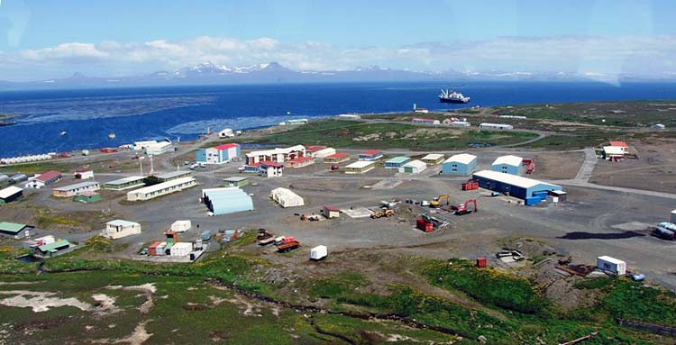
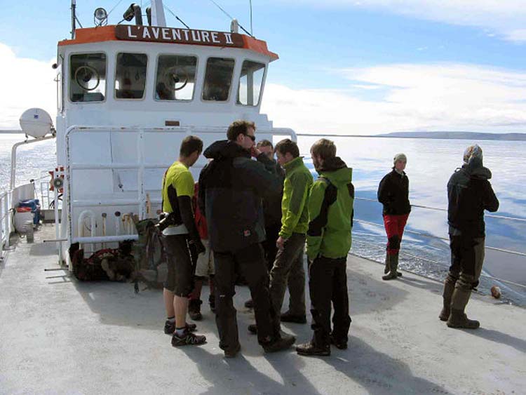
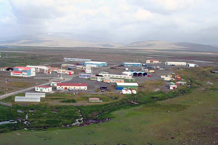
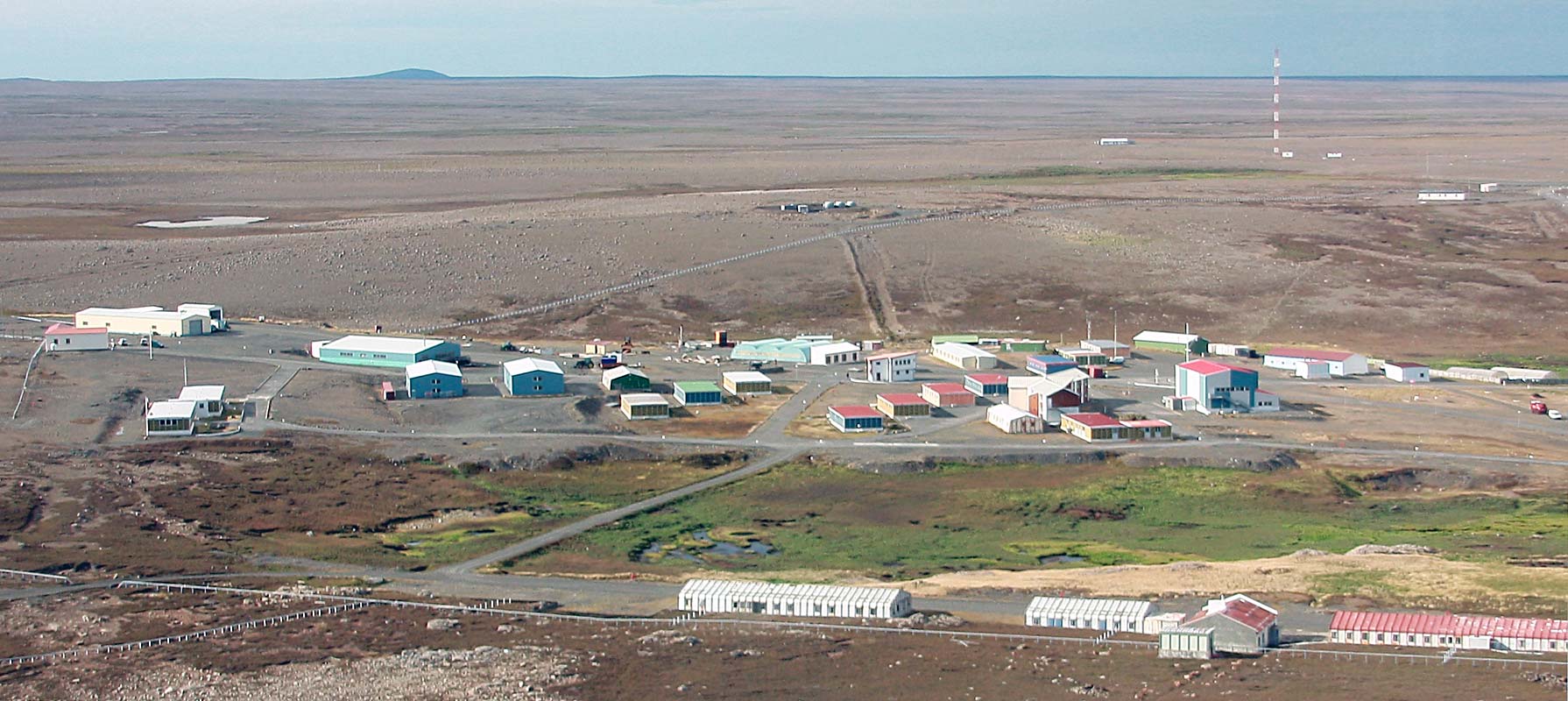
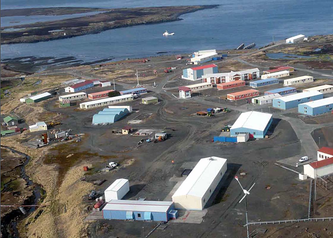
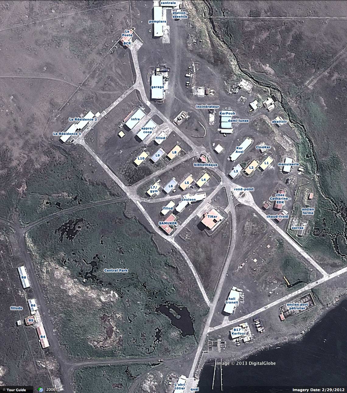
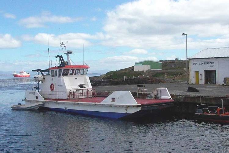
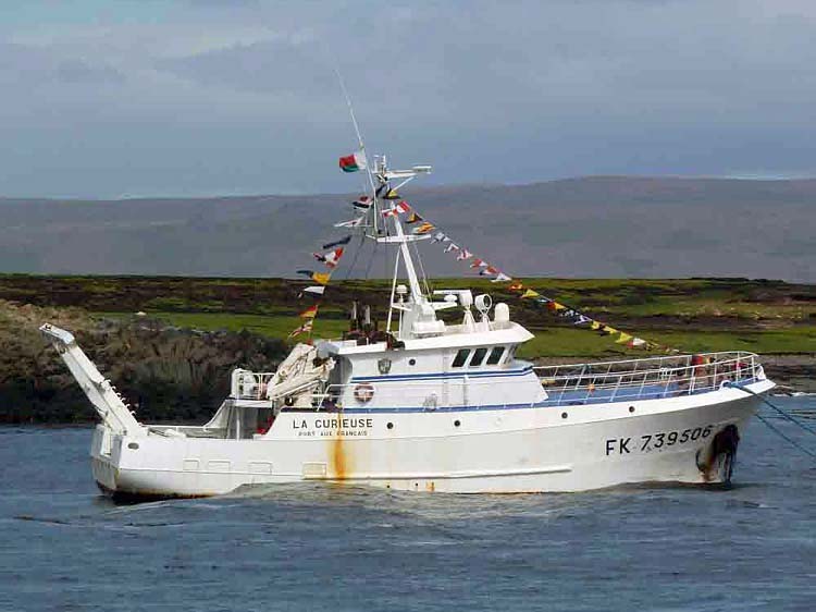
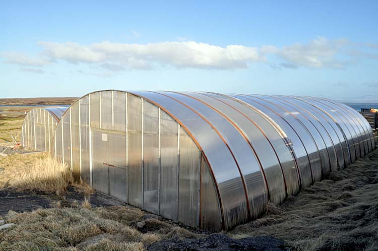
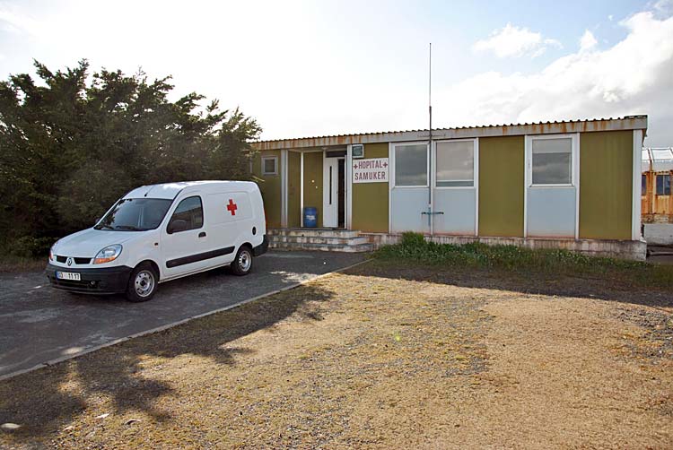
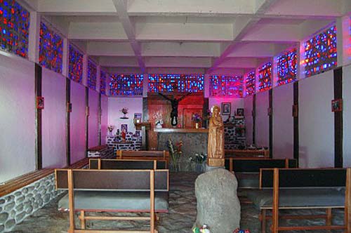
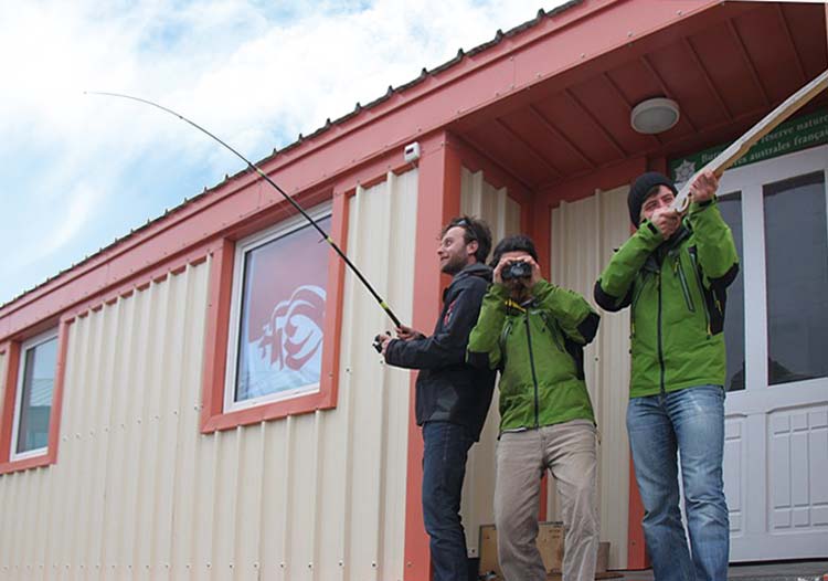
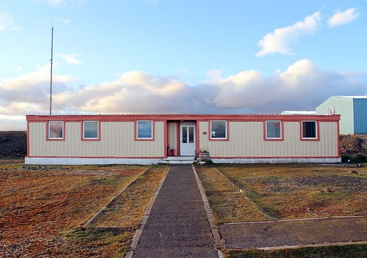
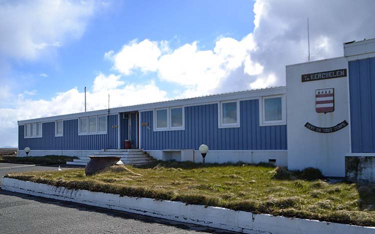
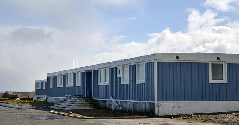
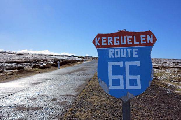
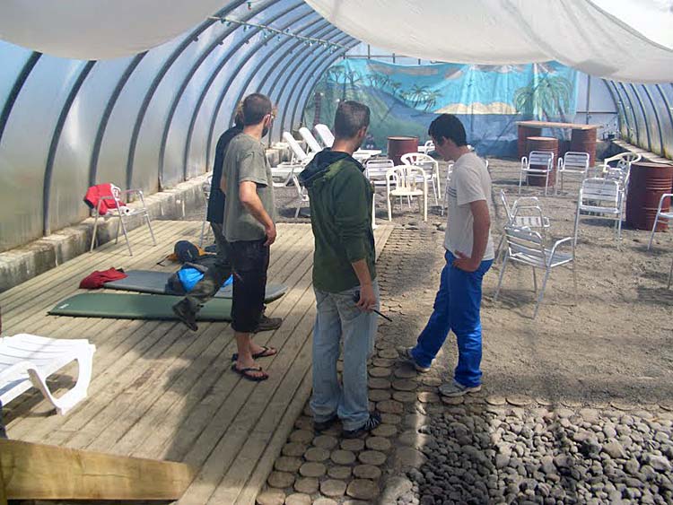
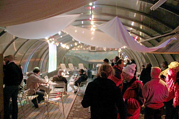
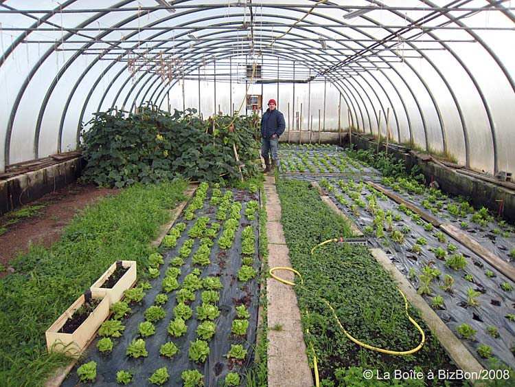
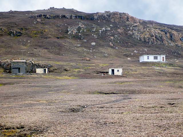
Port-aux-Français base station on Kerguelen Island; Marion Dufresne ship moored off-shore (click on image to see photo gallery) While there is no airport or landing strip on Kerguelen, the French base at Port-aux-Français (abbreviated and referred to as PAF) has a shallow seaport and a quay for unloading supply ships – including the R/V Marion Dufresne II (taafien: Mar'Duf), which stops at the island four times a year. Some equipment and supplies are brought by the ship's Écureuil helicopter, others are ferried from the Mar'Duf on a small barge named L'Aventure II which belongs to the base. When researchers need to visit islands in the Morbihan Gulf that are inaccessible on foot, L'Aventure also serves as their ticket to and from the remote locations. However, due to its flat-bottomed design, its travel is limited to the Gulf only; excursions further away – to locales accessible by open sea – are handled by the port's small ship called La Curieuse. Today's population of scientists and engineers at PAF varies between 60 and 120, depending on the season. The base is large and well-appointed, boasting a bar, boules courts (in a converted greenhouse!), chapel, cinema, hospital, library, post office, restaurant, satellite tracking station, scientific research buildings, and a sports center. The base is shared with CNES (the French National Space Center), whose operations are dedicated to the tracking of satellites – notably the Ariane rockets launched from Kourou in French Guiana. The CNES station is situated on a plateau 4 km (2.5 mi.) east of the PAF base, accessible via the "Route 66" road. (See satellite view[1] of base station.) There are also close to three dozen cabins or huts situated around the island to accommodate personnel engaged in research missions. Some of them are little more than a cramped box with rudimentary sleeping quarters, while others are full-fledged houses complete with kitchens, showers and toilets. As might be expected for an insular, specialized community like the Port-aux-Français base on Kerguelen, a unique lexicon has developed among its residents (les hivernants) over the years – one which provides insights into the social structure and division of labor on the island. Understandably, the glossary of terms is in French. Our article Lexique Taafien explores the evolution of a creole language among the TAAF personnel, and offers an encyclopedic glossary that outsiders will surely find amusing. [1] "Étang de la Décharge" is mistakenly shown in the satellite view at the location of Central Park on the PAF base. The true location of the pond where refuse and garbage were once dumped by the base is actually about 0.7 km to the northwest. (We are attempting to correct this issue with Google.) Notre-Dame du Vent, legacy of a 'worker-priest'Coordinates: 49°21'08.79"S, 70°12'54.01"E or decimal: -49.352442, 70.215003. Notre-Dame du Vent is the chapel at Port-aux-Français, and the southernmost French Catholic place of worship in the world. A few celebrations are held there throughout the year, generally conducted by a chaplain from the Marion Dufresne II. Constructed out of concrete with a stone foundation, its proportions are based on the Golden Ratio. The chapel is perfectly maintained by over-winterers at the base. 
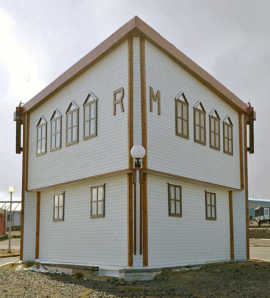
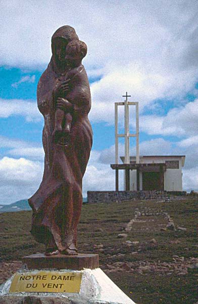
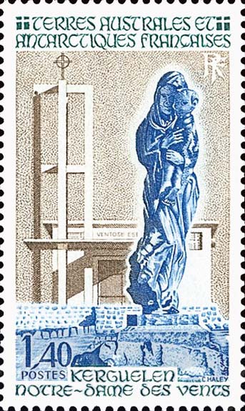
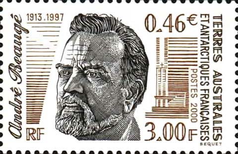
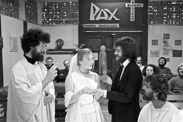
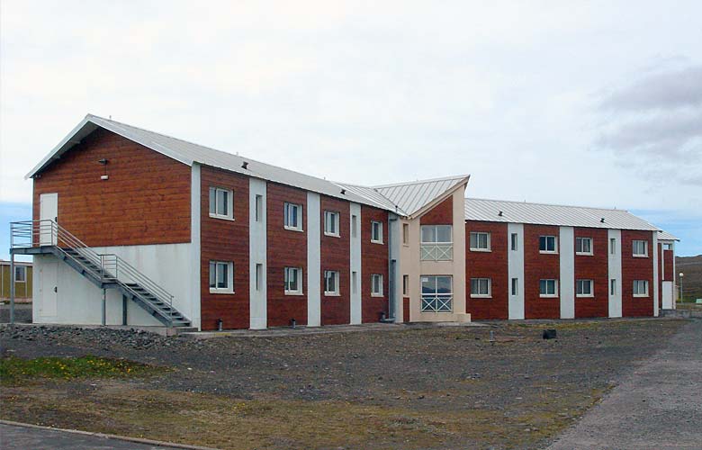
Exterior view of the chapel Notre-Dame des Vents at Port-aux-Français, Kerguelen (click on image to enlarge) Born in Le Relecq-Kerhuon (Finistère department of Brittany), André Beaugé (1913-1997) was a Capuchin friar, ordained as a priest in 1939. After suffering 5 years of captivity by the Germans during World War II, he became an ardent evangelist and organizer for the working class. The Vatican, however, suspecting that such "worker-priests" may be too closely allied with communism, issued a directive in 1954 prohibiting such activities – which did not sit well with Beaugé. He decided in 1956 to go to Kerguelen, where he was at first employed as a laborer by the TAAF administration, then by SIDAP – Société Industrielle des Abattoirs Parisiens, the last elephant-seal processing factory on the island – holding various jobs as a mechanic, nurse, carpenter, cook, and biologist – while also ministering to the base's religious needs. On 16 December 1957, Beaugé performed the first marriage on Kerguelen between SIDAP's founder Marc Péchenart and Martine Raulin. The ceremony took place in SIDAP's carpentry shop, witnessed by everyone from the base and the factory. Word of the southernmost French wedding also reached mainland France, and President Charles de Gaulle extended his congratulations on the union. Beaugé played a decisive role in getting a chapel built on the island. His strong personality, dedication, kindness, charisma, and prodigious intelligence endeared him to the entire population of the base, whether they came from Christian, Muslim, or other faiths. Everyone chipped in to help him build the structure, doing so after their daily work was finished – even on Sundays. In March 1958, Beaugé blessed the first foundation stone; as the structure neared completion, he designed the stained glass windows, which he financed himself. On 11 June 1960, he celebrated his first mass in the tiny chapel. As one might expect, a Breton influence is reflected in the religious artifacts at Notre-Dame du Vent, such as the sculptures which Beaugé commissioned in 1958 from Landerneau (Finistère, Brittany) native Robert Gourlaouen (1929-2001) – who created the Christ on the cross at the front of the chapel, as well as the wooden Virgin and Child statue mounted on a stone pedestal in the middle aisle, near the rear entrance. (There is another similar but larger statue outside, facing the Golfe du Morbihan.) One also notes the chapel's wrought-iron gate bearing the inscription Introun varia an avel, roughly translated from Breton as "Virgin Mary (of) the Wind". Sources: Frères Mineurs Capucins - Province de France (Order of Capuchin Friars Minor in France, an offshoot of the Franciscans). André Beaugé, 1913-1997 - Itinéraire d'un homme engagé, an article on the blog Bretons des Kerguelen, hosted by Le Télégramme. Pierre Couesnon, Historian for TAAF. Ça vous dirait, le Sud?, an article written by Yann Libessart, former district chief (DisKer) 2007-2008, on his blog Les manchots de la République, hosted by Libération.fr. Wikipedia, the free encyclopedia. Translation, editing, and portions written by Ian C. Mills © 2002-. All Rights Reserved. Residential QuartersLa LouisonCoordinates: 49°20'58.58"S, 70°13'07.73"E or decimal: -49.349606, 70.218814. The naming (or toponomy) of landmarks, artifacts, and bodies of water around Kerguelen, not to mention some of the buildings at Port-aux-Français, pay homage to the Breton origins of early explorers and later "settlers" on the islands. The newest residence La Louison continues that tradition, perhaps belying a certain sense of humor in the TAAF community. One of only three two-story buildings at PAF, it houses mostly military personnel including members of the French Army, Air Force, and Marines. 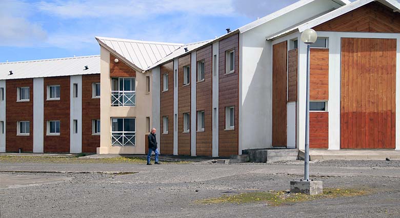
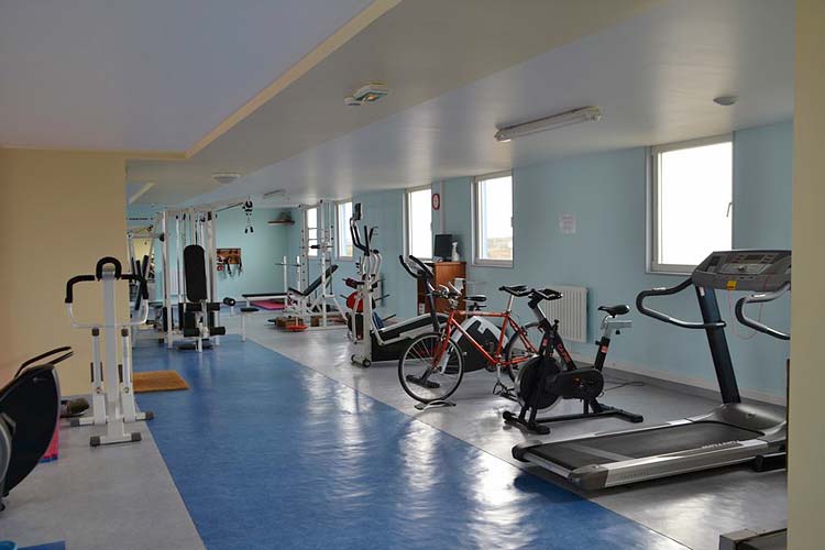
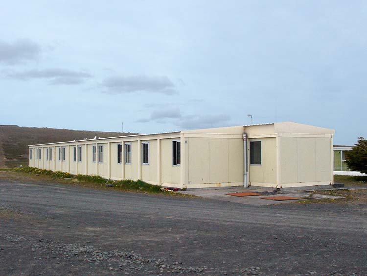
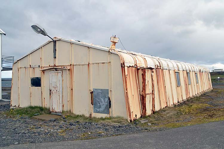
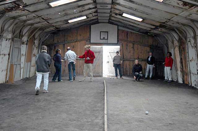
La Louison houses mostly military personnel at PAF. (click on image to enlarge) Marie-Louise Seguin, nicknamed "La Louison", came from a right-bank Breton quarter of Brest known as La Recouvrance. She was only a 14-year-old girl at the time that the 39-year-old commander Yves de Kerguelen de Trémarec smuggled her – disguised as a valet – on board Le Roland for his second voyage to the islands in March 1773; she was not added to the passenger manifest until after the departure. Her presence on the ship, in contravention of maritime regulations, did not remain clandestine for long. Combined with other disastrous factors of the voyage, the state of affairs on board resulted in a near mutiny among the crew. To complicate matters further, an ensign on the ship named Marc-Gaston Ducheyron allegedly lusted after the young girl, thus causing quite a rift with the commander. Upon the ship's return to Brest, "La Louison" left as discreetly as she had boarded. Nevertheless, Kerguelen was stripped of his rank, tried and convicted by tribunal on various counts of malfeasance, and sentenced to six years of house arrest at the Château de Saumur. During the tribunal, he claimed to have paid Marie-Louise a pension of 300 livres to spend the rest of her life in a convent. After serving little more than three years at Saumur, from 1775 to 1778, Kerguelen was released and resumed his naval career in Brest, retiring in 1796; he died in Paris the next year. A printed record of the 15 May 1775 tribunal proceedings against Kerguelen has been scanned and may be viewed in its entirety at Gallica, Bibliothèque Numérique (in old French, of course). The legacy of his young mistress is now preserved at Port-aux-Français. Also see articles: Yves de Kerguelen. Grandeur et désolation (July 2009, Le Télégramme) and Yves Joseph de Kerguelen de Trémarec (Wikipedia France). KeravelCoordinates: 49°20'56.13"S, 70°13'11.64"E or decimal: -49.348925, 70.2199. Keravel or Ker-Avel is a Breton name which translates roughly to "House of Wind". It is one of the older residences at Port-aux-Français, used primarily to house summer personnel when the base's population can swell to 120. It faces the L2 residence unit and one of the only two trees on the base – a stunted, windswept evergreen called Thuja occidentalis. (see Keravel photos) L1 to L10 BuildingsAs the scope of scientific missions on Kerguelen has expanded over the years, Port-aux-Français has also grown and gradually improved its lodging accommodations. Ten 'L' units (the letter stands for 'lodging' or 'logements' in French) were built to handle the increased number of overwintering personnel. All of the old Fillod-style residential buildings (B1 to B8, west of Central Park), which date back to the base's founding in the 1950s, have been abandoned as living quarters and now serve strictly as storage units; some of the 'B' buildings (B2, B3, B7) have been demolished. Expectations of modern comforts by today's recruits to the TAAF bases have also been reflected in the designs of newer lodging. Instead of the communal bathrooms typical in older construction (as still seen on the base at Terre Adélie, Antarctica), personnel on Kerguelen enjoy en suite facilities – adjoining their private bedrooms – although each 'L' unit offers a common lounge area. As part of an aggressive energy conservation campaign by TAAF, all the 'L' units have recently been refitted with new siding, additional insulation, double-paned thermal windows, and electric heating panels. The L7 unit was converted into the base's new exercise facility, replacing an aging and decrepit Fillod structure across the street that is destined for demolition. (Team sports such as badminton, basketball, hockey, and volleyball take place in the Transit Hall near the base's port; boules – or pétanque – is played in one of the former greenhouses.) 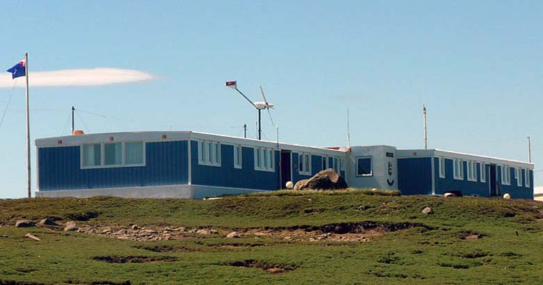
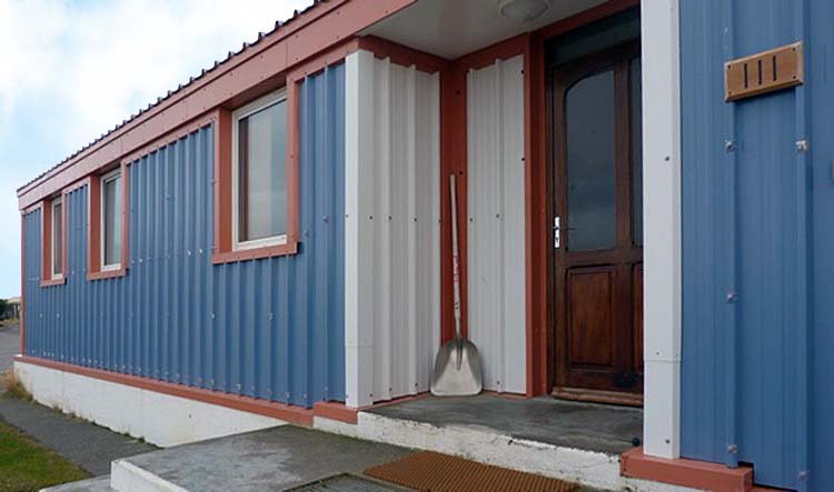
La Résidence, in two sections, houses the District Chief (left) and personnel from CNES/Météo-France (right). (click on image to view gallery) Non-military personnel are generally grouped together in each 'L' unit according to their fields of scientific research (eco-biology, geophysics, ornithology, etc.) or their occupational / technical specialties (HVAC, infrastructure, kitchen staff, mechanical, etc.). Such groupings aid in socialization between the workers, who will also tend to gravitate toward one another when dining at TiKer. District Chief's ResidenceCoordinates: 49°20'56.13"S, 70°13'11.64"E or decimal: -49.348631, 70.216478. Situated on the northwestern edge of the PAF community, La Résidence consists of two sections which were constructed in separate stages. The west wing contains the apartments of the island's district chief (taafien: DisKer) and a small reception hall which is sometimes used for official or ceremonial functions – such as visits from TAAF administrators, French government dignitaries and military officers. A later addition, the east wing currently houses personnel from CNES and Météo-France. Related videosFirst video: Kerguelen Islands. Bernard Aarts, President of INCA Arts (International Network of Commercial and Citizens Associations), presents this introductory slideshow which showcases the base at Port-aux-Français, assorted flora & fauna, and some of the majestic scenery on Kerguelen. (1:49) Editing, translation, and portions written by Ian C. Mills © 2000- – All Rights Reserved. For sources of information, recommended publications, photo and video credits, please refer to the Bibliography.
sign 1
sign 2
seal sign
road seal
samuker2
party
greenhouse3
greenhouse2
greenhouse4
cabanemolloy2
couvreux2
hope2
Next page >> The Art of Living on Kerguelen, Gastronomy, Facilities & Equipment, Satellite Tracking, Water Craft, Industry
|
||||||
|
||||||||||


